


Click Image to Enlarge
Texas Counties
Texas is divided into two hundred and fifty-four counties, more than any other state. Texas was originally divided into municipalities, a unit of local government under Spanish and Mexican rule. When the Republic of Texas gained its independence in 1836, there were 23 municipalities, which became the original Texas counties. Many of these would later be divided into new counties. The most recent county to be created was Kenedy County in 1921. The most recent county to be organized was Loving County in 1931Mason County, Texas
Mason County Education, Geography, and History
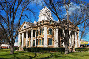
Mason County is a county located on the Edwards Plateau in the state of Texas. Based on the 2010 census, its population was 4,012. Its county seat is Mason. The county is named for Fort Mason, which was located in the county.
Etymology - Origin of Mason County Name
Fort Mason which was located in the future county
Demographics:
County QuickFacts: CensusBureau Quick Facts
Mason County History
Mason County is a county located in the US state of Texas. Its county seat is Mason. Mason County is named for Fort Mason, which was located in the county.
Handbook of Texas Online
In the mid-1840s the overflow of German colonists from Fredericksburg and New Braunfels, under the direction of John
O. Meusebach, began to move into what became Mason County, risking the dangers
of the wilderness for the opportunity to own larger tracts of land. The establishment of Fort Mason in 1851 and the
resulting greater protection against Indian attacks encouraged more rapid settlement of the county by Germans,
Irish, and English. Mason County was originally part of the Bexar District.
When Gillespie County was marked off in 1848, most of the future Mason County was included within its boundaries. On
January 22, 1858, Mason County, named for Fort Mason, was established by an act of the state legislature. George W.
Todd organized the county on August 2 of that year. The act required that a county seat be established within two
miles of the fort, and on May 20, 1861, voters chose the town of Mason for this purpose. The original boundaries of
the county have remained virtually unchanged over the years. Mason County grew slowly at first due to the danger of
Indian attacks (despite the presence of Fort Mason), and also because of the onset of the Civil War
shortly after the county was organized. Most early settlers were farmers, and agriculture centered around providing
basic necessities. In 1860 the chief crops were Indian corn and sweet potatoes. Cattle raising was the most
profitable business in Mason County from an early date, and ranchers began to stock the open ranges before the Civil
War More at
Alice J. Rhoades, "MASON COUNTY," Handbook of Texas Online (http://www.tshaonline.org/handbook/online/articles/hcm04),
accessed January 24, 2016. Uploaded on June 15, 2010. Published by the Texas State Historical Association.
Geography: Land and Water
As reported by the Census Bureau, the county has a total area of 932 square miles (2,414 km2), virtually all
of which is land.
Neighboring Counties
Bordering counties are as follows:
- McCulloch County (north)
- San Saba County (northeast)
- Llano County (east)
- Gillespie County (south)
- Kimble County (southwest)
- Menard County (west)
Education


Click Image to Enlarge
