


Click Image to Enlarge
Texas Counties
Texas is divided into two hundred and fifty-four counties, more than any other state. Texas was originally divided into municipalities, a unit of local government under Spanish and Mexican rule. When the Republic of Texas gained its independence in 1836, there were 23 municipalities, which became the original Texas counties. Many of these would later be divided into new counties. The most recent county to be created was Kenedy County in 1921. The most recent county to be organized was Loving County in 1931Midland County, Texas
Midland County Education, Geography, and History
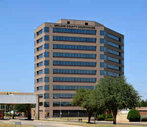
Midland County is a county located in the state of Texas. Based on the 2010 census, the population was 136,872. The county seat is Midland.
The county is so named as the county is halfway (midway) between Fort Worth and El Paso on the Texas and Pacific Railway.
Midland County is included in the Midland, TX Metropolitan Statistical Area as well as the Midland-Odessa Combined Statistical Area.
Etymology - Origin of Midland County Name
its location midway between Fort Worth and El Paso on the Texas and Pacific Railroad
Demographics:
County QuickFacts: CensusBureau Quick Facts
Midland County History
Midland County is a county located in the US state of Texas. Midland is named for the fact that the county is located halfway between Fort Worth, Texas and El Paso, Texas on the Texas and Pacific Railway. The seat of the county is the city of Midland
Handbook of Texas Online
Ranching began in the area after Herman Garrett shipped sheep from California to El Paso on the Southern Pacific
Railroad. Garrett drove 300 sheep across the Pecos River, at the present site of the town of Midland, before moving
on to Mustang Draw and settling in as the county's first permanent settler. Promotions by the Texas and Pacific
Railway, which built into the area in 1881, brought other sheepmen to what is now Midland County. Nelson Morris, a
Chicago meatpacker who bought 200,000 acres from the state for his Black Angus ranch, was the first to fence county
land. Cattle were introduced after ranchers discovered that abundant water could be obtained from wells. In 1885,
when 300 people were living in the area, the Texas state legislature established Midland County from lands
previously assigned to Tom Green County, and the county was organized later that same year. The town of Midland,
originally named Midway to suggest its place on the Fort Worth-El Paso rail line, became county seat. The Staked
Plains, the county's first newspaper, began publication in 1885, and another paper, the Midland Gazette,
was in circulation by 1889; the county's first school house was built the next year. By 1890 twenty-nine ranches had
been established in the county, and the agricultural census reported 14,867 cattle and 13,364 sheep in the area. No
crops were reported in the county that year, though some early settlers did grow limited amounts of corn and grain,
sometimes using irrigation. The United States Census counted 1,033 people living in Midland County in 1890. The area
had good soils but only sparse rainfall, and in 1891 the United States Department of Agriculture conducted a
rain-making experiment in the county; watermelons and pumpkins were planted in another experiment. Further
settlement in the area was encouraged when the Texas legislature passed the Four-Section Act
of 1895; this law enabled stockmen to buy four sections for each family member at favorable terms, and provided
opportunities for leasing range lands for a modest price. By 1900 there were seventy-three ranches in Midland
County, and cattle dominated the local economy. Almost 45,000 cattle were reported in the area that year, while the
number of sheep had declined to only 2,257. Only one acre of cropland was reported in the county that year; it was
planted in oats More at
John Leffler, "MIDLAND COUNTY," Handbook of Texas Online (http://www.tshaonline.org/handbook/online/articles/hcm12),
accessed January 24, 2016. Uploaded on June 15, 2010. Published by the Texas State Historical Association.
Geography: Land and Water
As reported by the Census Bureau, the county has a total area of 902 square miles (2,336 km2), of which, 900
square miles (2,332 km2) of it is land and 2 square miles (4 km2) of it (0.19%) is water.
Neighboring Counties
Bordering counties are as follows:
- Martin County (north)
- Glasscock County (east)
- Upton County (south)
- Ector County (west)
- Andrews County (northwest)
Education


Click Image to Enlarge
