


Click Image to Enlarge
Texas Counties
Texas is divided into two hundred and fifty-four counties, more than any other state. Texas was originally divided into municipalities, a unit of local government under Spanish and Mexican rule. When the Republic of Texas gained its independence in 1836, there were 23 municipalities, which became the original Texas counties. Many of these would later be divided into new counties. The most recent county to be created was Kenedy County in 1921. The most recent county to be organized was Loving County in 1931Montague County, Texas
Montague County Education, Geography, and History
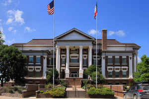
Montague County is a county located in the state of Texas, established in 1857. Based on the 2010 census, its population was 19,719. The county seat is Montague. The county was created in 1857 and organized the next year. It is named for Daniel Montague, a surveyor and soldier in the Mexican-American War.
Etymology - Origin of Montague County Name
Daniel Montague, a state senator and early surveyor in the future county
Demographics:
County QuickFacts: CensusBureau Quick Facts
Montague County History
Montague County is a county located in the US state of Texas. Montague is named for Daniel Montague, a surveyor and soldier in the Mexican-American War. The seat of the county is Montague
Handbook of Texas Online
Organization of the area occurred twenty years after the Texas Revolution of
1836. The state legislature established the county on Christmas Eve in 1857. The following year, on August 2, 1858,
the county was formally organized with its present boundaries carved from Cooke County. The new county was named for
Daniel Montague, surveyor of the Fannin Land District and veteran of the Mexican
War. Only three villages existed in the county at the time, and none of them was
near the geographic center of the county. So an uninhabited area at the appropriate location was identified as the
county seat and also named in honor of Daniel Montague. At the time the area of Montague County had less than 1,000
residents. A slight majority of these inhabitants had immigrated from the upper South, primarily Tennessee but also
from Kentucky and Arkansas. A substantial number arrived from north of the Mason-Dixon line, mostly farmers from
Illinois, Indiana, and Ohio. As a result of this immigration pattern, the county did not reproduce the slaveholding
plantation society that characterized the state. This in part explains the position Montague County took when voters
rejected secession 86 to 50 in 1861. The 849 residents, including thirty-four
slaves, may have been more concerned with preserving their lives than the union. If Texas joined the Confederacy,
federal troops would withdraw from the Red River area. Government soldiers provided the only protection from Indian
raids, and their removal would leave the underpopulated county exposed to attacks from Indians who far outnumbered
them. The next fifteen years confirmed their fears, as Indian raids forced farmers to abandon their homes. In 1863,
for example, an Indian attack wiped out the community of Illinois Bend. The end of the Civil War
did not resolve the problem. Bands of Comanche and Wichita Indians continued to harass the county until the
mid-1870s. As a result of these raids, in 1870 only 890 residents had settled in the county. During the first few
years of the 1870s, however, an organized effort successfully drove the Indians from the county, allowing the
governor in 1878 to pronounce that Montague County was no longer a frontier county. As the number of Indian raids
decreased, the number of settlers increased. By the early 1880s the population was 11,000. The abundance of
grasslands had attracted cattlemen as early as the late 1860s. In the fall of 1867 Montague County was the last
Texas county crossed by the Chisholm Trail before it entered Indian Territory.
For the next twenty-five years county residents concentrated their efforts on cattle raising, as a result farms
produced forage for livestock and food rather than cultivating a cash crop More at
David Minor, "MONTAGUE COUNTY," Handbook of Texas Online (http://www.tshaonline.org/handbook/online/articles/hcm16),
accessed January 24, 2016. Uploaded on June 15, 2010. Published by the Texas State Historical Association.
Geography: Land and Water
As reported by the Census Bureau, the county has a total area of 938 square miles (2,431 km2), of which, 931
square miles (2,410 km2) of it is land and 7 square miles (21 km2) of it (0.83%) is water.
Neighboring Counties
Bordering counties are as follows:
- Jefferson County, Oklahoma (north)
- Love County, Oklahoma (northwest)
- Cooke County (east)
- Wise County (south)
- Jack County (southwest)
- Clay County (west)
Education
The following school districts serve Montague County:
Alvord ISD (mostly in Wise County)
Bowie ISD (small portion in Clay, Jack counties)
Forestburg ISD
Gold-Burg ISD (small portion in Clay County)
Montague ISD
Nocona ISD
Prairie Valley ISD
Saint Jo ISD (small portion in Cooke County)
Slidell ISD (partly in Wise, Denton counties; small portion in Cooke County)
In addition, a branch of North Central Texas College operates in Bowie.


Click Image to Enlarge
