


Click Image to Enlarge
Texas Counties
Texas is divided into two hundred and fifty-four counties, more than any other state. Texas was originally divided into municipalities, a unit of local government under Spanish and Mexican rule. When the Republic of Texas gained its independence in 1836, there were 23 municipalities, which became the original Texas counties. Many of these would later be divided into new counties. The most recent county to be created was Kenedy County in 1921. The most recent county to be organized was Loving County in 1931Montgomery County, Texas
Montgomery County Education, Geography, and History
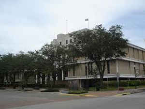
Montgomery County is a county in the state of Texas. Based on the 2010 census, its population was 455,746. A 2013 estimate places the
population at 499,137. The county seat is Conroe. The county was created by an act of the Congress of the Republic of Texas on December 14,
1837 and is named for the town of Montgomery.
Montgomery County is part of the Houston-The Woodlands-Sugar Land, TX Metropolitan Statistical Area.
Etymology - Origin of Montgomery County Name
Montgomery, Texas, which was the largest town in the county when Montgomery County, Texas was formed, was named for Montgomery, Alabama, which was named after General Richard Montgomery of the American Revolution.
Demographics:
County QuickFacts: CensusBureau Quick Facts
Montgomery County History
Montgomery County is a county located in the US state of Texas. The county was created by an act of the Congress of the Republic of Texas on December 14, 1837. The county was named for the town of Montgomery, Texas
Handbook of Texas Online
The earliest European explorer of what became Montgomery County was probably the Frenchman Ren?Robert Cavelier,
Sieur de La Salle, who evidently passed through the area in 1687. When news of
French incursions reached Spanish authorities, they sent several expeditions to the region to reclaim it for Spain.
During the mid-eighteenth century the Spanish made several attempts to establish settlements in the area and
eventually set up three missions on the banks of Spring Creek within the current boundaries of Montgomery County,
but the missions were abandoned in 1756 and no permanent Spanish settlements were made. The future Montgomery County
area was included in the colonization contracts issued by Spanish and later Mexican authorities to empresario
Stephen F. Austin, and during the early 1820s Anglo-American settlers began
moving into the region. Forty-two families of Austin's colony obtained land titles from the Mexican government and
settled in western Montgomery County. Among the earliest settlers was Andrew Montgomery,
who established a trading post at the crossroads of the Loma del Toro and lower Coushatta traces. He was soon joined
by relatives and others, and the settlement eventually grew into the town of Montgomery. During the early 1830s the
population of the region increased rapidly, and in December, 1837 the Republic of Texas
Congress established Montgomery County, which was named for its largest settlement. The new county was carved from
Washington County, and its borders originally extended from the Brazos River on the west to the Trinity on the east,
and from the Old San Antonio Road on north to the San Jacinto River on the south, an area which included future
Grimes, Walker, San Jacinto, Madison, and Waller counties. The county's present boundaries were established after
the establishment of Waller County in 1870. More at
Christopher Long, "MONTGOMERY COUNTY," Handbook of Texas Online (http://www.tshaonline.org/handbook/online/articles/hcm17),
accessed January 24, 2016. Uploaded on June 15, 2010. Modified on November 24, 2015. Published by the Texas State Historical Association.
Geography: Land and Water
As reported by the Census Bureau, the county has a total area of 1,077 square miles (2,789 km2), of which,
1,044 square miles (2,704 km2) of it is land and 33 square miles (85 km2) of it (3.04%) is water.
Neighboring Counties
Bordering counties are as follows:
- Walker County (north)
- San Jacinto County (northeast)
- Liberty County (east)
- Harris County (south)
- Waller County (west)
- Grimes County (Northwest)
Education
Public schools
Several school districts operate public schools in the county:
Conroe ISD
Magnolia ISD
Montgomery ISD
New Caney ISD
Richards ISD (partial)
Splendora ISD
Tomball ISD (partial)
Willis ISD (partial)
Private schools
Pre-K to 12
Covenant Christian School
Christ Community School
The Woodlands Christian Academy
The John Cooper School
St. Anthony Of Padua Catholic School
The Woodlands Preparatory School
Porter Christian Academy
The county also is home to two campuses of the Lone Star College System: Montgomery and The University Center. The county operates the
Montgomery County Memorial Library System


Click Image to Enlarge
