


Click Image to Enlarge
Texas Counties
Texas is divided into two hundred and fifty-four counties, more than any other state. Texas was originally divided into municipalities, a unit of local government under Spanish and Mexican rule. When the Republic of Texas gained its independence in 1836, there were 23 municipalities, which became the original Texas counties. Many of these would later be divided into new counties. The most recent county to be created was Kenedy County in 1921. The most recent county to be organized was Loving County in 1931Ochiltree County, Texas
Ochiltree County Education, Geography, and History
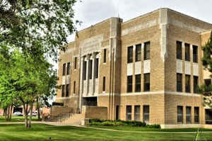
Ochiltree County is a county located in the state of Texas. Based on the 2010 census, its population was 10,223. The county seat is Perryton. The county was created in 1876 and organized in 1889. and is named for William Beck Ochiltree, who was the Attorney General of the Republic of Texas.
Etymology - Origin of Ochiltree County Name
William Beck Ochiltree, an early settler in Texas, judge, and legislator
Demographics:
County QuickFacts: CensusBureau Quick Facts
Ochiltree County History
Ochiltree County is a county located in the US state of Texas. The county seat is Perryton. The county is named for William Beck Ochiltree, who was the Attorney General of the Republic of Texas.
Handbook of Texas Online
Prehistoric cultures occupied this region, then the Plains Apaches appeared. The historic-era Apaches arrived,
then were pushed out of the region in the early eighteenth century by the Comanche Indians, who dominated the Texas
Panhandle until the 1870s. The Red River War of 1874-75 led to the removal of
the nomadic Indians to Indian Territory, which in turn led to the arrival of the ranching era. In 1876 the Texas
legislature established Ochiltree County from lands formerly assigned to the Bexar District. Ranching arrived a
little later in Ochiltree County than it did farther south in the Panhandle. By 1885 Henry W. Cresswell
had purchased or leased most of the county and established the Cresswell Ranch
(Bar CC) on Wolf Creek in the eastern part of the county and moved its headquarters from Roberts County to the new
site on Wolf Creek. His company, the Cresswell Land and Cattle Company of Colorado, was syndicated as the Cresswell
Ranch and Cattle Company by 1885. The Cresswell Ranch controlled most of the land in the county. Dee Eubank and Tom
Connell, who arrived on Wolf Creek in 1879, controlled much smaller acreages in the eastern part of Ochiltree and
the western part of Lipscomb counties. After the blizzards of 1886-87 county lands were opened to settlement by
stock farmers who operated on a much smaller scale. The availability of land in Ochiltree County coincided with the
proximity of a new railroad. In 1887 the Southern Kansas Railway Company of Texas, a Santa Fe subsidiary, built a
line from Kansas through Oklahoma into the Panhandle via Canadian and Panhandle. This line passed through Lipscomb
County, thirty to forty miles east of Ochiltree. Thus the county was only one or two days' travel from the railroad.
Proximity to the railroad brought an influx of settlers into the county, especially after 1900, and the ranching
economy evolved into a stock-farming system. Between 1890 and 1900 the number of ranches in the area increased from
forty-seven to seventy-one, and the number of cattle grew from 10,000 to 84,000. At the same time the area's
population rose from 198 to 267. Almost no crops were grown in the area at the beginning of the twentieth century,
though some ranchers did grow corn and vegetables for their own consumption. Between 1900 and 1910, however, stock
farming began to give way to wheat farming. As local stock farmers determined that wheat was a viable crop and new
settlers moved into the area, the local economy shifted. By 1910 there were 264 farms and ranches in the area,
encompassing almost 226,000 acres, including more than 53,000 acres reported to be "improved." That year the
agricultural census reported 9,000 acres planted in wheat in the county; another 2,075 acres were planted in corn,
and 7,400 acres were devoted to sorghum. By the beginning of World War I
Ochiltree County possessed a diversified agricultural economy poised for expansion. By 1920 there were 336 farms and
ranches; almost 42,000 acres were planted in wheat, and 14,500 acres devoted to sorghum. Poultry raising was also
becoming significant to the economy by this time; in 1920 23,000 chickens were reported on county farms. Cattle
ranching continued but was less important than it once had been. About 24,000 cattle were reported in the county
that year More at
Donald R. Abbe, "OCHILTREE COUNTY," Handbook of Texas Online (http://www.tshaonline.org/handbook/online/articles/hco01),
accessed January 24, 2016. Uploaded on June 15, 2010. Published by the Texas State Historical Association.
Geography: Land and Water
As reported by the Census Bureau, the county has a total area of 918 square miles (2,378 km2), of which, 917
square miles (2,376 km2) of it is land and 1 square miles (2 km2) of it is water. The total area is 0.06 percent
water.
Neighboring Counties
Bordering counties are as follows:
- Texas County, Oklahoma (north)
- Beaver County, Oklahoma (northeast)
- Lipscomb County (east)
- Roberts County (south)
- Hansford County (west)
Education
Of the population aged 25 and older (5,441 people), 14.6 percent did not have a high school diploma, while the 12.9 statewide are without a
high school diploma. Twenty-seven percent of the county claimed that a high school diploma was their highest level of educational attainment,
compared with 24.8 percent statewide; 16.1 percent had a Bachelor's degree or higher, compared with 23.2 percent statewide.
The Allen Campus of Frank Phillips College is located in Perryton


Click Image to Enlarge
