


Click Image to Enlarge
Texas Counties
Texas is divided into two hundred and fifty-four counties, more than any other state. Texas was originally divided into municipalities, a unit of local government under Spanish and Mexican rule. When the Republic of Texas gained its independence in 1836, there were 23 municipalities, which became the original Texas counties. Many of these would later be divided into new counties. The most recent county to be created was Kenedy County in 1921. The most recent county to be organized was Loving County in 1931Pecos County, Texas
Pecos County Education, Geography, and History
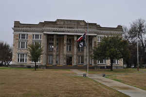
Pecos County is a county located in the state of Texas. Based on the 2010 census, its population was 15,507. The county seat is Fort Stockton. The county was created in 1871 and organized in 1875. It is named for the Pecos River. It is one of the nine counties that comprise the Trans-Pecos region of West Texas.
Etymology - Origin of Pecos County Name
the Pecos River
Demographics:
County QuickFacts: CensusBureau Quick Facts
Pecos County History
Archeological digs at Squawteat Peak uncovered prehistoric hunter-gatherer artifacts. 14 clusters of stones
interpreted as wickiup and tipi rings indicate human habitation. A ring midden in the camp provided a radiocarbon date of 1300 A.D.
Archeological finds along Tunas Creek include a burial site, pictographs, and artifacts; a possible modified Langtry projectile point (2,000
B.C. to A.D. 700-800).
The Comanche Trail crossed Pecos County near Horsehead Crossing and through Comanche Springs. The Chihuahua Trail connecting Mexico's state of
Chihuahua with Santa Fe, New Mexico brought travelers through the area by Comanche Springs about 1840.
United States Army outpost, Fort Stockton, was established in 1858 at Comanche Springs to guard the San Antonio-El Paso Mail. That same year
the Butterfield Overland Mail began service to the army post.
The town of Fort Stockton began near the Fort Stockton army post at Comanche Springs as St. Gall, but was renamed in 1880. Pecos County was
established by the Texas legislature in 1871 originally out of Presidio County. It is named for the Pecos River. The county was organized in
1875. St. Gall (Fort Stockton), became the county seat.
Handbook of Texas Online
The land of Pecos County was originally in Bexar Territory and later part of Presidio County. Pecos County was
established by the Texas legislature in 1871. The county was formally organized on March 9, 1875, at St. Gall, which
became the county seat. There were 1,100 people living in the county that year. The United States agricultural
census for 1880 reported 150 ranches and farms in the area. Most holdings were less than ten acres in size, and all
but one had less than 500 acres; the average holding was sixty-one acres. About 2,500 acres in the county were
planted in corn that year, along with seven acres of oats and twenty acres of wheat. During the 1880s St. Gall was
renamed Fort Stockton, and the army post closed, causing a temporary economic slump in the county due to lost trade
and employment. The county lost virtually all of its small landholders during the 1880s; in 1883 parts of the county
land was split off to form Reeves and Terrell counties, and in 1885 another part was incorporated into the new Val
Verde County. By 1890 only twelve ranches, together encompassing 14,564 acres, remained. All but one were larger
than 500 acres in size. The county had 227 cattle and 150 sheep that year, and 1,300 acres were planted in corn. By
1900 the area's population had increased to 2,360. There were ninety-five ranches and farms, encompassing 2,159,000
acres, in Pecos County that year; the holdings averaged 22,721 acres in size. The area's economy had become almost
completely dominated by cattle and sheep ranching, though plots of wheat, rye, corn, and oats were grown. The
agricultural census reported 74,000 cattle and 142,000 sheep in the area that year. By 1910 there were only
fifty-six farms and ranches in the county, and the population had declined to 2,071. Ranching dominated the local
economy more than ever. Only $200 worth of cereals and vegetables were grown in the county in 1910, but there were
109,000 cattle and 61,000 sheep that year. More at
Glenn Justice and John Leffler, "PECOS COUNTY," Handbook of Texas Online (http://www.tshaonline.org/handbook/online/articles/hcp05),
accessed January 24, 2016. Uploaded on June 15, 2010. Published by the Texas State Historical Association.
Geography: Land and Water
As reported by the Census Bureau, the county has a total area of 12,341 square kilometers (4,765 sq mi).
12,338 km2 (4,764 sq mi) of it is land and 3 km2 (1 sq mi) of it (0.02%) is water.
The 300,000-acre (1,214 km2) La Escalera Ranch is located 20 miles (32 km) south of Fort Stockton and is owned and
operated by the Gerald Lyda family. The ranch extends over much of Pecos County and portions of Reeves, Brewster and
Baylor Counties. Originally owned by California-based Elsinore Land & Cattle Company, the 100-year old ranch was
acquired by Gerald Lyda of San Antonio, Texas and re-named La Escalera Ranch (Spanish for "The Ladder"). It is known
for its reputation herd of crossbred Angus cattle and its abundant wildlife. Located near the entrance to the ranch
is Sierra Madera crater, which was created when a huge meteor struck the earth.
Neighboring Counties
Bordering counties are as follows:
- Ward County (north)
- Crane County (north)
- Crockett County (east)
- Terrell County (southeast)
- Brewster County (southwest)
- Jeff Davis County (west)
- Reeves County (northwest)
Education


Click Image to Enlarge
