


Click Image to Enlarge
Texas Counties
Texas is divided into two hundred and fifty-four counties, more than any other state. Texas was originally divided into municipalities, a unit of local government under Spanish and Mexican rule. When the Republic of Texas gained its independence in 1836, there were 23 municipalities, which became the original Texas counties. Many of these would later be divided into new counties. The most recent county to be created was Kenedy County in 1921. The most recent county to be organized was Loving County in 1931Reeves County, Texas
Reeves County Education, Geography, and History
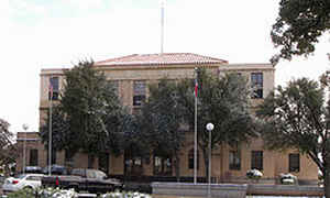
Reeves County is a county located in the state of Texas. Based on the 2010 census, its population was 13,783. Its county seat is Pecos. The
county was created in 1883 and organized the next year. It is named for George R. Reeves, a Texas state legislator and colonel in the
Confederate Army. It is one of the nine counties that comprise the Trans-Pecos region of West Texas.
Reeves County comprises the Pecos, TX Micropolitan Statistical Area.
Etymology - Origin of Reeves County Name
George Robertson Reeves, a state legislator and colonel in the Confederate army
Demographics:
County QuickFacts: CensusBureau Quick Facts
Reeves County History
Prehistoric Clovis culture peoples in Reeves County lived in the rock shelters and caves nestled near water supplies.
These people left behind artifacts and pictographs as evidence of their presence. Jumano Indians led the Antonio de Espejo 1582-1583
expedition near Toyah Lake on a better route to the farming and trade area of La Junta de los Ríos. Espejo's diary places the Jumano along the
Pecos River and its tributaries. The Mescalero Apache frequented San Solomon Springs to irrigate their crops. In 1849 John Salmon "RIP" Ford
explored the area between San Antonio and El Paso noting in his mapped report the productive land upon which the Mescalero Indians farmed.
Toyah Valley farmers George B. and Robert E. Lyle were the first Anglo settlers 1871. White settlers started arriving in the area four years
later, lured by open range ranching. For the remainder of the century, the county economy was dependent upon farming and ranching as it segued
into the manufacturing and oil industries of the 20th century.
The state legislature formed Reeves from Pecos County in 1883, and named it after Texas legislator and soldier George Robertson Reeves. The
county was organized in 1884. The town of Pecos was named as county seat.
Handbook of Texas Online
By 1881 the Texas and Pacific Railway built tracks through Reeves County. At that time section houses were
constructed at Pecos and Toyah, which opened a post office that year and later became a shipping point for local
ranchers. Pecos was named the seat of government when Reeves County was separated from Pecos County in 1883 and
organized in 1884. Pecos constructed a three-room school in 1883 and opened a post office in 1884. The county was
named for Confederate colonel George R. Reeves. The name of the first community
was Saragosa, which opened a post office in 1884. The name was changed to Lyles in 1891 and to Toyahvale in 1894. By
1885, when several ranchers herded cattle on the northern range of the county, Pecos reported 150 residents and
Toyah had sixty. By 1890 the county population had expanded to 1,247, including seven African Americans,
fifteen Chinese, and 351 foreign-born residents. In that year a second railroad,
the Pecos River, constructed fifty-four miles of tracks from Pecos to the New Mexico line along the river, providing
transportation for local agricultural products. In 1894 a post office was established at Brogado, nine miles
southeast of Pecos, and Toyah built its first school. By 1899 Toyahvale had a public school district with three
schools, and during the 1899-1900 school term the Pecos school had 111 students and three teachers. A second school
was added for the 1900-01 term with 148 pupils and four teachers. A second community called Saragosa, located in the
southernmost part of the county, was designated a post office in 1900. In that year the census reported a total of
1,847 county residents, including 474 foreign-born, twelve African Americans, and ten Chinese. In 1902 Toyah
organized its first church. Reeves County reported five manufacturing establishments that employed sixteen workers
at wages totalling $8,835 and made products worth $30,085 in 1900. Manufacturers increased to nine by 1920, with
sixty-two employees earning just over $88,000 and producing $187,000 worth of goods. From 1940 to 1967 the number of
manufacturers grew from five to seventeen, but that number declined to eleven in 1982. The values of production over
those years increased from $165,807 in 1940 to $3.6 million by 1977, but manufacturing remained secondary to
agriculture and petroleum in the county economy More at
Julia Cauble Smith, "REEVES COUNTY," Handbook of Texas Online (http://www.tshaonline.org/handbook/online/articles/hcr06),
accessed January 24, 2016. Uploaded on June 15, 2010. Published by the Texas State Historical Association.
Geography: Land and Water
As reported by the Census Bureau, the county has a total area of 2,642 square miles (6,843 km2), of which,
2,636 square miles (6,827 km2) of it is land and 6 square miles (16 km2) of it (0.23%) is water.
Neighboring Counties
Bordering counties are as follows:
- Eddy County, New Mexico (north)
- Loving County (northeast)
- Ward County (east)
- Pecos County (southeast)
- Jeff Davis County (southwest)
- Culberson County (west)
Education


Click Image to Enlarge
