


Click Image to Enlarge
Texas Counties
Texas is divided into two hundred and fifty-four counties, more than any other state. Texas was originally divided into municipalities, a unit of local government under Spanish and Mexican rule. When the Republic of Texas gained its independence in 1836, there were 23 municipalities, which became the original Texas counties. Many of these would later be divided into new counties. The most recent county to be created was Kenedy County in 1921. The most recent county to be organized was Loving County in 1931Refugio County, Texas
Refugio County Education, Geography, and History
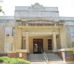
Refugio County is a county located in the state of Texas. Based on the 2010 census, the population was 7,383. Its county seat is Refugio. The county was created as a municipality of Mexico in 1834 and organized as a county in 1837
Etymology - Origin of Refugio County Name
Nuestra Senora del Refugio Mission which was located near the future county
Demographics:
County QuickFacts: CensusBureau Quick Facts
Refugio County History
Refugio County is a county located in the US state of Texas. Its seat is Refugio
Handbook of Texas Online
Refugio County lost much of its coastland during the 1870s when the county was divided after a political dispute
between coastal and inland residents. Refugio had served as the county seat since 1836, but the Constitution of 1869
officially designated St. Mary's the county seat. The records, however, stayed in Refugio. Partly because most of
the county's population increase since the Civil War had been along the coast, on March 15, 1871, the legislature
changed the county seat to Rockport. The records were temporarily moved, but the older settlers in the region
objected so strongly that on April 18, 1871, the legislature established Aransas County with its county seat at
Rockport and fixed the seat of government for Refugio County at "the mission." Partly because of the
Mexican-American exodus and the consolidation of ranchlands and partly because of the physical division of the
county, the number of farms in the county fell from 176 in 1870 to 123 in 1880; the population also declined
significantly during that period, dropping to 1,733 by 1880. The loss of a considerable part of its coastal area and
the absence of a railroad hampered the growth of Refugio County in the late nineteenth century. Though the number of
farms grew slowly, rising to 159 by 1900, the number of cattle declined from 77,300 in 1880 to less than 36,000 by
1900; the number of sheep declined from 7,400 in 1880 to less than 2,000. Meanwhile the population of the county
dropped to only 1,239 in 1890 before rising slightly to 1,641 by the end of the century. In 1900, operating under
strict segregation guidelines, white schools were found in Refugio, St. Mary's,
Westville, Morrowville, Tivoli, and Hynes Bay; black schools were in Refugio, St. Mary's, Medio, and Hynes Bay. That
year 269 students, both black and white, were enrolled in Refugio county schools More at
John Leffler, "REFUGIO COUNTY," Handbook of Texas Online (http://www.tshaonline.org/handbook/online/articles/hcr07),
accessed January 24, 2016. Uploaded on June 15, 2010. Published by the Texas State Historical Association.
Geography: Land and Water
As reported by the Census Bureau, the county has a total area of 819 square miles (2,120 km2), of which, 770
square miles (1,995 km2) of it is land and 49 square miles (125 km2) of it (5.92%) is water.
Neighboring Counties
Bordering counties are as follows:
- Victoria County (north)
- Calhoun County (northeast)
- Aransas County (southeast)
- San Patricio County (south)
- Bee County (west)
- Goliad County (northwest)
Education


Click Image to Enlarge
