


Click Image to Enlarge
Texas Counties
Texas is divided into two hundred and fifty-four counties, more than any other state. Texas was originally divided into municipalities, a unit of local government under Spanish and Mexican rule. When the Republic of Texas gained its independence in 1836, there were 23 municipalities, which became the original Texas counties. Many of these would later be divided into new counties. The most recent county to be created was Kenedy County in 1921. The most recent county to be organized was Loving County in 1931Roberts County, Texas
Roberts County Education, Geography, and History
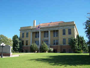
Roberts County is a county located in the state of Texas. Based on the 2010 census, its population was 929, making it the seventh-least populous county in Texas. Its county seat is Miami. The county was created in 1876 and organized in 1889. It is named for Oran Milo Roberts, a governor of Texas.
Etymology - Origin of Roberts County Name
Oran Milo Roberts, the seventeenth governor of Texas, and John S. Roberts, a signer of the Texas Declaration of Independence
Demographics:
County QuickFacts: CensusBureau Quick Facts
Roberts County History
Plains Apaches inhabited the Texas Panhandle until they were displaced by the Comanches who dominated the area until
the 1870s. The Comanches hunted the large herds of Buffalo, which grazed on the prairie. In the Red River War of 1874-75, United States Army
troops led by Ranald S. Mackenzie drove out the Comanches. Simultaneously, buffalo hunters killed the large herds in the area, making way for
permanent settlements.
In 1876, Roberts County was carved from Bexar County and the Clay Land District. Roberts is named for Oran Milo
Roberts, governor of Texas, and for John S. Roberts, a signer of the Texas Declaration of Independence.
Handbook of Texas Online
In 1887 the Southern Kansas Railway built a line from the Oklahoma border into the Panhandle, passing through
Roberts County and linking up with Panhandle City the following year. Settlers followed in the wake of the railroad,
and the town of Miami was platted out along the railroad in the southeastern part of the county in the summer of
1887. Settlers around Miami petitioned for county government, while cattlemen and settlers along the Canadian River
in the northern part of the county framed a counter petition with Parnell, a small settlement in the northwestern
part of the county, as proposed county seat. The county was organized in January of 1889, and Miami was chosen as
the county seat, but the election was declared fraudulent in December, and Parnell was chosen county seat instead.
Parnell remained the county seat until 1898, after another election relocated the seat of county government back to
Miami. By 1890 Roberts County had a population of 326 and thirty-four farms and ranches. Among the important ranches
were the Cresswell Ranch, the Turkey Track Ranch, and the Cross Bar Ranch. Miami prospered as the shipping point for
cattle. The county population slowly grew to 620 in 1900, 950 in 1910, and a peak of 1,469 in 1920. The county
economy centered on cattle raising, and the number of cattle increased from 30,259 in 1900 to a peak of 48,959 in
1930. During the same period the county developed a modest farming economy, increasing from 3,576 improved acres in
1900 to 44,751 in 1930. Wheat was by far the most important crop, increasing from 1,423 acres in 1910 to 29,350
acres in 1920, to a peak of 34,102 acres, over three quarters of the cropland harvested that year, in 1930. Corn,
oats, and cotton were also grown at different times. The Dust Bowl and the Great Depression
dealt hard blows to the farming industry of Roberts County, as the number of acres in cultivation declined by a
quarter during the 1930s, and the value of county farms dropped by a third. Roberts County's population was
relatively static in the 1920s, with 1,457 inhabitants in 1930. Thereafter a long term decline set in, as the county
population fell to 1,289 in 1940, 1,031 in 1950, and 967 in 1970 and then recovered slightly to 1,025 in 1990; there
were 887 people living in the county in 2000. Throughout its history Roberts County has remained one of the most
sparsely populated counties in the state. Most of the inhabitants of the county have been white of English, Irish,
and German descent; in 2000 blacks comprised 0.34 percent of the county's residents and Hispanics made up less than
4 percent of the population More at
Mark Odintz, "ROBERTS COUNTY," Handbook of Texas Online (http://www.tshaonline.org/handbook/online/articles/hcr08),
accessed January 24, 2016. Uploaded on June 15, 2010. Published by the Texas State Historical Association.
Geography: Land and Water
As reported by the Census Bureau, the county has a total area of 924 square miles (2,394 km2), virtually all
of which is land.
Neighboring Counties
Bordering counties are as follows:
- Ochiltree County (north)
- Lipscomb County (northeast)
- Hemphill County (east)
- Gray County (south)
- Carson County (southwest)
- Hutchinson County (west)
- Hansford County (northwest)
Education


Click Image to Enlarge
