


Click Image to Enlarge
Texas Counties
Texas is divided into two hundred and fifty-four counties, more than any other state. Texas was originally divided into municipalities, a unit of local government under Spanish and Mexican rule. When the Republic of Texas gained its independence in 1836, there were 23 municipalities, which became the original Texas counties. Many of these would later be divided into new counties. The most recent county to be created was Kenedy County in 1921. The most recent county to be organized was Loving County in 1931Terry County, Texas
Terry County Education, Geography, and History
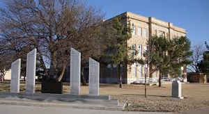
Terry County is a county located in the state of Texas. Based on the 2010 census, its population was 12,651.] Its county seat is Brownfield. The county was created in 1876 and later organized in 1904. It is named for Benjamin Franklin Terry, a colonel in the Confederate Army.
Etymology - Origin of Terry County Name
Benjamin Franklin Terry, a Confederate colonel and commander of Terry's Texas Rangers (Eighth Texas Cavalry)
Demographics:
County QuickFacts: CensusBureau Quick Facts
Terry County History
In 1877, the ill-fated Nolan Expedition crossed the county in search of livestock stolen by Comanche renegades. The
various Indian tribes had moved on by the time of white settlement, due to the depletion of the buffalo herds by hunters.
Terry County was formed from Bexar County in 1876 and named for Col. Benjamin Franklin Terry, who commanded the Terry's Texas Rangers in the
Civil War.
Terry County was organized in 1904. Brownfield as became the county seat
Handbook of Texas Online
The area that is now Terry County includes lands granted by Mexico to Stephen J. Wilson in 1826 and John Charles
Beales in 1832, but the Texas Revolution
prevented any settlement on grant lands of West Texas. The land had been a hunting ground for Comanches and other
Indians who preyed on the great herds of buffalo in the area, but buffalo
hunters depleted the herds during the early 1870s. Terry County was demarked from Bexar County in 1876 and named for
Col. Benjamin Franklin Terry, who commanded the Eighth Texas Cavalry
(Terry's Texas Rangers) in the Civil War. It was attached to Young County until
1881, when Throckmorton County took over its judicial affairs. In 1883 administration was vested in Howard County,
and in 1889 it was transferred to Martin County. The county began to be settled by whites in the 1890s, when the
state offered ten-year leases on school lands for grazing cattle. Terry County was organized in 1904, with
Brownfield as its seat of government. More at
William R. Hunt and John Leffler, "TERRY COUNTY," Handbook of Texas Online (http://www.tshaonline.org/handbook/online/articles/hct04),
accessed January 24, 2016. Uploaded on June 15, 2010. Published by the Texas State Historical Association.
Geography: Land and Water
As reported by the Census Bureau, the county has a total area of 891 square miles (2,308 km2), of which, 890
square miles (2,305 km2) of it is land and 1 square miles (3 km2) of it (0.12%) is water.
Neighboring Counties
Bordering counties are as follows:
- Hockley County (north)
- Lynn County (east)
- Dawson County (southeast)
- Gaines County (south)
- Yoakum County (west)
Education


Click Image to Enlarge
