


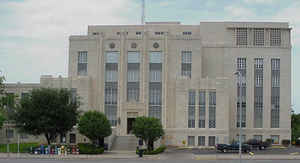
Click Image to Enlarge
Texas Counties
Texas is divided into two hundred and fifty-four counties, more than any other state. Texas was originally divided into municipalities, a unit of local government under Spanish and Mexican rule. When the Republic of Texas gained its independence in 1836, there were 23 municipalities, which became the original Texas counties. Many of these would later be divided into new counties. The most recent county to be created was Kenedy County in 1921. The most recent county to be organized was Loving County in 1931Travis County, Texas
Travis County Education, Geography, and History
Travis County is a county located in south central Texas. Based on the 2010 census, the population was 1,024,266; the estimated population in
2014 was 1,151,145. It is the fifth-most populous county in Texas. Its county seat is Austin, the capital of Texas. The county was established
in 1840 and is named in honor of William Barret Travis, the commander of the Republic of Texas forces at the Battle of the Alamo.
Travis County is part of the Austin-Round Rock Metropolitan Statistical Area. It is located along the Balcones Fault, the boundary between the
Edwards Plateau to the west and the Blackland Prairie to the east.
Etymology - Origin of Travis County Name
William Barret Travis, the commander of the Texian forces at the Alamo
Demographics:
County QuickFacts: CensusBureau Quick Facts
Travis County History
Travis County is located in the US state of Texas. I Its county seat is Austin, the capital of Texas. The county is named in honor of William Barret Travis, the commander of the Republic of Texas forces at the Battle of the Alamo.
Handbook of Texas Online
Settlement resumed after the revolution, but it proceeded slowly because of the constant threat of raids by the
Comanche Indians. During the 1830s a chain of small forts ranged from Bastrop northwest along Wilbarger's Bend,
Coleman Branch, Webber's Prairie, and Gilleland Creek, to Fort Colorado or Fort Prairie, five miles east of the site
of present Austin. In June 1835 Thomas Jefferson Chambers surveyed part of an
eight-league grant covering the present site of Austin and the Capitol. Sometime
before 1837 William Barton settled near the springs that were to bear his name.
In 1837 or 1838 President Mirabeau B. Lamar was on a buffalo hunt in the area
and commented on its possibilities as a site for the permanent capital. In 1838 the community of Waterloo (Austin)
consisted of four families; about twenty families established homes at nearby Montopolis in 1839. When the Congress
of the Republic of Texas chose Waterloo as the site of the new capital,
opponents were quick to point out the disadvantages: the site's proximity to the frontier, the lack of timber, the
poor soil, and the threat of Indian raids. In spite of this opposition, however, the new capital- renamed Austin in
honor of Stephen F. Austin- was approved on January 19, 1840. A few days later the Congress established Travis
County, naming it in honor of William Barret Travis and making Austin its county
seat. An election for county officials was held in February 1840, at which time the population was reported to be
856. The initial boundaries of Travis County included roughly 40,000 square miles. Counties that were later carved
from Travis County include Callahan (1858), Coleman (1858), Comal (1846), Gillespie (1848), Hays (1848), Burnet
(1852), Brown (1856), Lampasas (1856), Eastland (1858), Runnels (1858), and Taylor (1858). Sam Houston
moved the government of the Republic of Texas from Austin to Houston when Mexican troops invaded San Antonio in
March 1842. When he tried to have the government archives removed as well, Austin citizens resisted with the
Archives War. The Texas Congress held sessions at Washington-on-the-Brazos from
1842 to 1845, but the convention that drafted the Constitution of 1845 met in
Austin in July 1845, and by October the rest of the government had returned to the capital city. The first
legislature of the new state convened in Austin in February 1846. More at
Vivian Elizabeth Smyrl, "TRAVIS COUNTY," Handbook of Texas Online (http://www.tshaonline.org/handbook/online/articles/hct08),
accessed January 24, 2016. Uploaded on June 15, 2010. Modified on December 11, 2015. Published by the Texas State Historical Association.
Geography: Land and Water
Travis County is in Central Texas, about 75 miles northeast of San Antonio and 150 miles west of Houston. The
Colorado River flows through Travis County, and three of the Texas Highland Lakes (Lake Travis, Lake Austin and Lady
Bird Lake) are located there.
As reported by the Census Bureau, the county has a total area of 1,022 square miles (2,647 km2). 989 square miles
(2,562 km2) are land and 33 square miles (85 km2) (3.21%) are water.
Neighboring Counties
Bordering counties are as follows:
- Williamson County (north)
- Bastrop County (east)
- Caldwell County (south)
- Hays County (southwest)
- Blanco County (west)
- Burnet County (northwest)
Education
School districts
Travis county is served by a number of public school districts; the largest is Austin Independent School District, serving most of Austin. Other districts wholly or mainly located in Travis County include Eanes ISD, Lake Travis ISD, Lago Vista ISD, Leander ISD, Del Valle ISD, Manor ISD, and Pflugerville ISD. Parts of Elgin ISD, Coupland ISD, Round Rock ISD, Marble Falls ISD, Johnson City ISD, Dripping Springs ISD and Hays Consolidated ISD also cross into Travis County.
Colleges and universities
The largest university in Travis County is the University of Texas at Austin. Other universities include St. Edward's University, Huston-Tillotson University, and Concordia University Texas. The region's major community college system is Austin Community College District.


Click Image to Enlarge
