


Click Image to Enlarge
Texas Counties
Texas is divided into two hundred and fifty-four counties, more than any other state. Texas was originally divided into municipalities, a unit of local government under Spanish and Mexican rule. When the Republic of Texas gained its independence in 1836, there were 23 municipalities, which became the original Texas counties. Many of these would later be divided into new counties. The most recent county to be created was Kenedy County in 1921. The most recent county to be organized was Loving County in 1931Uvalde County, Texas
Uvalde County Education, Geography, and History
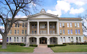
Uvalde County is a county located in the state of Texas. Based on the 2010 census, its population was 26,405. Its county seat is Uvalde. The
county was created in 1850 and organized in 1856. It is named for Juan de Ugalde, the Spanish governor of Coahuila. Uvalde County was founded
by Reading Wood Black who also founded the city of Uvalde, Texas.
Uvalde County comprises the Uvalde, TX Micropolitan Statistical Area.
Etymology - Origin of Uvalde County Name
the Ca?n de Ugalde, a nearby battlefield where Spanish General Juan de Ugalde won a surprise battle against 300 Apaches in the Sabinal River canyon on January 9, 1790
Demographics:
County QuickFacts: CensusBureau Quick Facts
Uvalde County History
Artifacts establish human habitation dating back to 7000 B.C. Evidence of a permanent Indian village on the Leona
River at a place south of the Fort Inge site is indicated in the written accounts of Fernando del Bosque's exploration in 1675. Comanche,
Tonkawa, Seminole and Lipan Apache continued hunting and raiding settlers into the 19th Century.
On January 9, 1790, Juan de Ugalde, governor of Coahuila and commandant of the Provincias Internas, led 600 men to a decisive victory over the
Apaches near the site of modern Utopia at a place known then as Arroyo de la Soledad. In honor of his victory, the canyon area was thereafter
called Canon de Ugalde. French botanist Jean-Louis Berlandier visited the area in the late 1820s. James Bowie guided a group of silver
prospectors into the area of north central Uvalde County in the 1830s. A trail used by General Adrian Woll's Mexican Army on its way to attack
San Antonio in 1842 crossed the territory of Uvalde County and became the main highway between San Antonio.
Fort Inge was established in 1849 to repress Indian depredations on the international border with Mexico, and was served by the Overland
Southern Mail.
One of the first settlers to the environs was William Washington Arnett, who arrived in the winter of 1852. The Canyon de Ugalde Land Company,
formed by land speculators in San Antonio in 1837, began purchasing headright grants in Uvalde County in the late 1830s. Reading Wood
Black,who with a partner, Nathan L. Stratton, purchased an undivided league and labor on the Leona River in 1853 at the future site of
Uvalde. May 2, 1855, Black hired San Antonio lithographer Wilhelm Carl August Thielepape,and laid out Encina, the town later known as Uvalde.
Waresville settlement by Capt. William Ware in the upper Sabinal Canyon and Patterson Settlement by George W. Patterson, John Leakey, and A.
B. Dillard on the Sabinal River coincided with Reading Black's development of the Leona River at Encina.
In November 1855, Reading Wood Black successfully lobbied the Texas legislature to organize Uvalde County. On May 12, the county was formally
organized. On June 14, Encina was named county seat.
Handbook of Texas Online
Uvalde County was formed by legislative act from Bexar County on February 8, 1850, but failed to secure a
permanent county status because of an insufficient number of settlers. Of equal importance to the early history of
the county was the development of the farming and ranching settlements at Waresville by Capt. William Ware
in the upper Sabinal Canyon and Patterson Settlement by George W. Patterson, John Leakey, and A. B. Dillard on the
Sabinal River; these settlements coincided with Reading Black's development of the Leona River at Encina. A second
attempt by Black to organize the territory resulted in a petition to form a county encompassing the area of the
present Kinney, Maverick, and Uvalde counties. The petition was approved in 1855 by the citizens of Eagle Pass, Los
Moras, Patterson Settlement, and Encina. A much smaller Uvalde County was established by legislative enactment on
February 2, 1856; four months later, on June 14, Encina was made county seat and renamed Uvalde. Slow but steady
progress marked the pre-Civil War years. The second floor of the courthouse was made into a school, and six school
districts were organized for the county in 1858. The San Antonio-El Paso Mail
route was extended along the county's main road with a stop at Fort Inge in 1857. The estimated population increased
from seventy-five in 1853 to 442 by 1858. Thomas B. Hammer established a store at the intersection of the Sabinal
River and the San Antonio-Eagle Pass road. Comanche and Apache raids significantly hindered development. Seminoles,
Tonkawas, and Lipan Apaches swept down the Leona River valley and attacked ranches near Fort Inge soon after its
temporary abandonment in 1857. Many settlers along the Nueces River moved to Laredo, and many along the Leona moved
to San Antonio or concentrated in a defensive stockade, known as Fort Anglin, built on Anglin's Creek More at
Ruben E. Ochoa, "UVALDE COUNTY," Handbook of Texas Online (http://www.tshaonline.org/handbook/online/articles/hcu03),
accessed January 24, 2016. Uploaded on June 15, 2010. Published by the Texas State Historical Association.
Geography: Land and Water
As reported by the Census Bureau, the county has a total area of 1,559 square miles (4,037 km2), of which,
1,557 square miles (4,031 km2) of it is land and 2 square miles (5 km2) of it (0.13%) is water.
Neighboring Counties
Bordering counties are as follows:
- Real County (north)
- Bandera County (northeast)
- Medina County (east)
- Zavala County (south)
- Kinney County (west)
- Edwards County (northwest)
Education


Click Image to Enlarge
