


Click Image to Enlarge
Texas Counties
Texas is divided into two hundred and fifty-four counties, more than any other state. Texas was originally divided into municipalities, a unit of local government under Spanish and Mexican rule. When the Republic of Texas gained its independence in 1836, there were 23 municipalities, which became the original Texas counties. Many of these would later be divided into new counties. The most recent county to be created was Kenedy County in 1921. The most recent county to be organized was Loving County in 1931Willacy County, Texas
Willacy County Education, Geography, and History
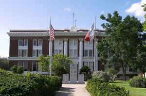
Willacy County is a county located in the state of Texas. Based on the 2010 census, its population was 22,134. Its county seat is
Raymondville. The county was created in 1911 and organized the next year.
Willacy County comprises the Raymondville, TX Micropolitan Statistical Area, which is included in the Brownsville-Harlingen-Raymondville,
TX Combined Statistical Area.
Etymology - Origin of Willacy County Name
John G. Willacy, a farmer, real estate developer, and Texas state senator who was the author of the bill that established the county
Demographics:
County QuickFacts: CensusBureau Quick Facts
Willacy County History
Willacy County was formed in 1911 from parts of Cameron and Hidalgo counties and originally included what is now Kenedy County; it was named for state senator John G. Willacy. Kenedy was split from Willacy in 1921, when the long-settled ranchers of the northern (Kenedy) part of the county sought to separate from the newly arrived farmers of the southern part. Its county seat is Raymondville.
Handbook of Texas Online
In 1911 Willacy County was formed from Cameron and Hidalgo counties;
the county seat was Sarita. Milt White introduced the Bermuda onion
to Willacy County in 1912, and it gradually became the most important
crop. As late as 1920 the county still had no paved roads, and La Sal
Vieja was still supplying the area with salt. The region that is now
Willacy County had become Anglo territory by the early 1920s. Its population
was 1,032 in 1920 and 4,515 in 1930. Unlike their nineteenth-century
predecessors, the newcomers who poured into the area after 1904 had
no inclination to learn Tejano customs or become incorporated
in the older culture. Labor and race relations changed as the new Anglo
farmers attributed the widespread poverty of the region to a lack of
industriousness and ambition on the part of Mexican laborers. County
officials forbade Mexicans from holding dances and fiestas, kept them
under surveillance, and passed laws making Willacy County dry. Race
relations worsened during the raids of the early 1900s. More at
Alicia A. Garza, "WILLACY COUNTY," Handbook of Texas Online (http://www.tshaonline.org/handbook/online/articles/hcw10),
accessed January 24, 2016. Uploaded on June 15, 2010. Published by the Texas State Historical Association.
Geography: Land and Water
As reported by the Census Bureau, the county has a total area
of 784 square miles (2,031 km2), of which, 597 square miles (1,545 km2)
of it is land and 188 square miles (486 km2) of it (23.92%) is water.
Neighboring Counties
Bordering counties are as follows:
- Kenedy County (north)
- Gulf of Mexico (east)
- Cameron County (south)
- Hidalgo County (west)
Education
School districts that serve Willacy County include:
Lasara Independent School District (K-8)
Lyford Consolidated Independent School District
Raymondville Independent School District
San Perlita Independent School District
In addition, residents are allowed to apply for magnet schools operated by the South Texas Independent School District.


Click Image to Enlarge
