


Click Image to Enlarge
Texas Counties
Texas is divided into two hundred and fifty-four counties, more than any other state. Texas was originally divided into municipalities, a unit of local government under Spanish and Mexican rule. When the Republic of Texas gained its independence in 1836, there were 23 municipalities, which became the original Texas counties. Many of these would later be divided into new counties. The most recent county to be created was Kenedy County in 1921. The most recent county to be organized was Loving County in 1931Yoakum County, Texas
Yoakum County Education, Geography, and History
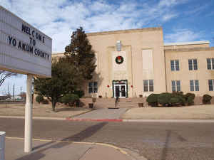
Yoakum County is a county located in the far western portion of the state of Texas. Based on the 2010 census, the population was 7,879. Its county seat is Plains. The county was created in 1876 and later organized in 1907. It is named for Henderson King Yoakum, a Texas historian.
Etymology - Origin of Yoakum County Name
Henderson King Yoakum, soldier, attorney, and Texas historian
Demographics:
County QuickFacts: CensusBureau Quick Facts
Yoakum County History
Early tribes included Suma-Jumano, Comanche, Cheyenne and Kiowa.
The Texas legislature established Yoakum County from Bexar County in 1876. The county was organized in 1907, and Plains became the county
seat. The county is named for
Henderson King Yoakum, a Texas historian
Handbook of Texas Online
The area that is now Yoakum County was off the path of most early explorations, but Fray Juan de Salas
crossed the region in 1632 on his second visit to the Jumano Indians. Comanche, Cheyenne, and Kiowa tribes made the
land their own until buffalo hunters and bone gatherers ventured in after 1870.
In 1876 the Texas legislature established Yoakum County from lands formerly assigned to the Bexar District, but in
1890 the United States census found only four people living in the area, and as late as 1900 the county had only
twenty-six residents. The economy was entirely dominated by cattle ranching at that time. In 1900 the agricultural
census listed only one ranch in the county; 6,200 cattle were reported, but no crops. Sale of state land after 1900
brought an increase in population. Early settlers traveled along Sulphur Springs Draw. In 1905 William Jackson Luna
established a store and post office at Plains, and when Yoakum County was organized in 1907, Plains became the
county seat. By 1910 there were 107 farms or ranches in the area, and the population had increased to 602. Almost
23,000 cattle were reported that year, but crop farming remained limited. About 3,000 acres were planted in sorghum,
the county's biggest crop, and 1,700 acres were planted in corn; only two acres were planted in cotton. The county
gained a newspaper in 1910 when Neil H. Bigger began publication of the Yoakum County News. Farmers suffered
during the 1910s despite some brief attempts to grow wheat and the start of a flourmill at Bronco in 1915. By 1920
there were 109 ranches or farms in the area, but the population had fallen to 504. More than 21,000 cattle were
reported that year, but crop cultivation remained limited; about 2,200 acres were planted in corn, 600 in sorghum,
and 47 in cotton. During the 1920s the county experienced a minor expansion of crop farming, and cotton became the
most important crop; by 1930 over 10,000 acres were devoted to cotton. There were 239 farms, and the population had
increased to 1,263. Substantial economic development began after 1936, when oil was discovered. Intensive production
quickly ensued, and in 1938 more than 1,239,000 barrels of crude were produced in the county. The boom centered at
Denver City, founded in 1939, and by 1940 the county population had jumped to 5,345. Meanwhile, agriculture
declined. By 1940 only 5,000 acres were planted in cotton, and the number of cattle had dropped 10 percent since
1930. Oil production intensified during the 1940s as Yoakum County became one of the leading oil-producing counties
in the state. Almost 18,413,000 barrels were produced in 1944, for example, and almost 25,222,000 barrels in 1948.
Production dropped to 19,027,000 barrels in 1956 and 13,330,000 barrels in 1963, then jumped to 77,632,000 barrels
in 1974. In 1990 more than 32,858,000 barrels of crude were produced in Yoakum County, and by January 1, 1991,
almost 1,664,036,000 barrels of oil had been taken from county lands since 1936 More at
John Leffler, "YOAKUM COUNTY," Handbook of Texas Online (http://www.tshaonline.org/handbook/online/articles/hcy01),
accessed January 24, 2016. Uploaded on June 15, 2010. Published by the Texas State Historical Association.
Geography: Land and Water
As reported by the Census Bureau, the county has a total area of 800 square miles (2,071 km2), virtually all
of which is land.
Neighboring Counties
Bordering counties are as follows:
- Cochran County (north)
- Terry County (east)
- Gaines County (south)
- Lea County, New Mexico (west)
Education


Click Image to Enlarge
