


Click Image to Enlarge
Texas Counties
Texas is divided into two hundred and fifty-four counties, more than any other state. Texas was originally divided into municipalities, a unit of local government under Spanish and Mexican rule. When the Republic of Texas gained its independence in 1836, there were 23 municipalities, which became the original Texas counties. Many of these would later be divided into new counties. The most recent county to be created was Kenedy County in 1921. The most recent county to be organized was Loving County in 1931Zapata County, Texas
Zapata County Education, Geography, and History
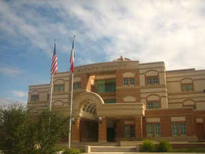
Zapata County is a county located in the state of Texas. Based on the 2010 census, its population was 14,018. Its county seat is Zapata. The
county is named for Colonel Jose Antonio de Zapata, a rancher in the area who rebelled against Mexico.
Zapata County comprises the Zapata, TX Micropolitan Statistical Area.
Etymology - Origin of Zapata County Name
Colonel Jose Antonio de Zapata, a local rancher and rebel against the Mexican government
Demographics:
County QuickFacts: CensusBureau Quick Facts
Zapata County History
Zapata County is a county located in the US state of Texas.Its county seat is Zapata. Zapata is named for Colonel Jose Antonio de Zapata, a rancher in the area and rebel against Mexico.
Handbook of Texas Online
From the Texas Revolution until the Mexican War
the region was disputed territory, claimed by both Texas and Mexico. In 1839-40 Antonio Zapata and other residents
joined Antonio Canales Rosillo and Jes? C?denas to fight for the Republic of
the Rio Grande. Despite political turmoil, the population of the area continued
to grow. By 1848 thirty-nine porciones and fifteen other tracts of land had been granted to individuals
either by Spanish authorities or by the Mexican government. But raids by Comanches, Apaches, and other Indians
continued to plague the settlers. During the 1850s Dolores Hacienda was destroyed by Indians, and sporadic attacks
on isolated haciendas continued until well after the Civil War. Among the
earliest Anglo-Americans in the region was Henry Redmond, who in 1839 filed a claim for a headright that became
known as Habitaci? de Redmond. A small settlement eventually grew up at the site, which was called Habitaci? until
1858, when it was renamed Bellville. In 1848 the Treaty of Guadalupe Hidalgo
established the Texas claim to the region, and the area of future Zapata County was included in Starr and Webb
counties. On January 22, 1858, the legislature passed a measure establishing Zapata County, which was organized on
April 26, 1858, with Bellville (later known as Carrizo and subsequently as Zapata) as the county seat. More at
Alicia A. Garza and Christopher Long, "ZAPATA COUNTY," Handbook of Texas Online (http://www.tshaonline.org/handbook/online/articles/hcz01),
accessed January 24, 2016. Uploaded on June 15, 2010. Published by the Texas State Historical Association.
Geography: Land and Water
As reported by the Census Bureau, the county has a total area of 1,058 square miles (2,740 km2), of which, 997
square miles (2,582 km2) of it is land and 61 square miles (159 km2) of it (5.80%) is water.
Neighboring Counties
Bordering counties are as follows:
- Webb County (north)
- Jim Hogg County (east)
- Starr County (southeast)
- Guerrero, Tamaulipas, Mexico (west)
Education
All of Zapata County is a part of the Zapata County Independent School District.


Click Image to Enlarge
