


Click Image to Enlarge
Texas Counties
Texas is divided into two hundred and fifty-four counties, more than any other state. Texas was originally divided into municipalities, a unit of local government under Spanish and Mexican rule. When the Republic of Texas gained its independence in 1836, there were 23 municipalities, which became the original Texas counties. Many of these would later be divided into new counties. The most recent county to be created was Kenedy County in 1921. The most recent county to be organized was Loving County in 1931Zavala County, Texas
Zavala County Education, Geography, and History
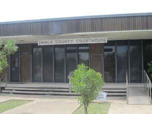
Zavala County is a county located in the state of Texas. Based on the 2010 census, the population was 11,677. Its county seat is Crystal City. The county was created in 1858 and later organized in 1884. Zavala is named for Lorenzo de Zavala, Mexican politician, signer of the Texas Declaration of Independence, and first vice president of the Republic of Texas.
Etymology - Origin of Zavala County Name
Lorenzo de Zavala, a Mexican rancher, politician, and signer of the Texas Declaration of Independence who served as the first Vice-President of the Republic of Texas
Demographics:
County QuickFacts: CensusBureau Quick Facts
Zavala County History
Radiocarbon assays indicate the county's Tortuga Flat Site was used in the 15th and 16th centuries by Pacuache.
Archeologist T. C. Hill of Crystal City conducted excavations in 1972-1973 at the site, uncovering artifacts. More than 100 archeological
sites have been identified by researchers of the University of Texas at San Antonio at the Chaparrosa Ranch. Coahuiltecan, Tonkawa, Lipan
Apache and Mescalero Apache and Comanche have inhabited the area after the Pacuache.
The area between the Rio Grande and the Nueces River, which included Zavala County, became disputed territory known as the Wild Horse Desert,
where neither the Republic of Texas nor the Mexican government had clear control. Ownership was in dispute until the Mexican-American War. The
area became filled with lawless characters who deterred settlers in the area. An agreement signed between Mexico and the United States in the
1930s put the liability of payments to the descendants of the original land grants on Mexico. According to a list of Spanish and Mexican
grants in Texas (found in the Book, "With All Arms," by Carl Laurence Duaine, New Santander Press, Edinberg, TX, 1987), Pedro Aguirre owned
51,296 acres in Zavala County, while Antonio Aguirre had 34,552. Seven other people (including two women-Juana Fuentes and Maria Escolastica
Diaz-each had 4,650 acres.
Zavala County was established in 1846 and named for Lorenzo de Zavala, a Mexican colonist and one of the signers of the Texas Declaration of
Independence. The county was organized in 1858, with an error putting an additional 'L' in the county. The mistake was not corrected until
1929. Batesville became the county seat. Crystal City won a 1928 election to become the new county seat
Handbook of Texas Online
Zavala County is in an area of Texas that was disputed territory after the Texas Revolution.
The Mexican government and the Republic of Texas both laid claim to the land. In
an attempt to reinforce the choice of the Rio Grande as the Texas boundary with Mexico, the state legislature in
1846 established a county between the Nueces River and the Rio Grande and called it Zavala County, named for Lorenzo
de Zavala, a Mexican colonist and one of the signers of the Texas Declaration of
Independence. Until 1858 the area was attached to the municipality of San
Antonio, then to Kinney County, and later to Maverick County. In 1858, when the county was organized, the name was
misspelled "Zavalla" by the legislature. A bill entitled "knocking the `L' out of Zavalla" was introduced and passed
in the Texas legislature in 1906, but was rejected by the federal government. Not until 1929 was the mistake
corrected. The development of the Old Presidio Road, the introduction of cattle, and the herds of mustangs
in the region provided the commercial and economic foundation for mid-nineteenth-century settlement of Zavala
County. The border area of the Rio Grande Plain was from the earliest period of occupancy a livestock domain, where
pioneer stockmen grazed their herds on free range. Beales's Rio Grande colony
(1832), which included land in Dimmit and Zavala counties, used the Upper Presidio Road as a reference point. In
1860 Zavala County had an estimated population of twenty-six and consisted primarily of small ranches. Espantosa
Lake, in the southwestern part of the county, was a favorite campground for travelers from Mexico to San Antonio. By
1870 large herds of longhorn cattle and mustangs roamed the area. Both cattle
and sheep were raised, especially along the larger streams. The earliest permanent settlement occurred in the
eastern half of the county along the Leona River; ranches there included the Woodward, Hill, and Bates; Batesville
was established in 1870. Early settlement of the county also began along the Upper Presidio Road at Murlo (1871), a
family-run trading post in northwest Zavala County, and at the ranching community of Cometa (1872) in southeastern
Zavala County. The population in 1880 was 410, and the county seat, Batesville, was a town of only thirty-eight
inhabitants. In 1880 there were 3,284 cattle and 7,046 sheep in the county. An estimated 21,800 pounds of wool was
produced in 1890, by which time the number of cattle had risen to 32,726 and the number of sheep to 14,722. The
first Zavala County Commissioners Court was held on March 20, 1884. The first road approved by the court was from
Bates City south to the Comanche Ditch Farm, one of the oldest irrigation
projects in Texas, thence to Dimmit County by way of Loma Vista More at
Ruben E. Ochoa, "ZAVALA COUNTY," Handbook of Texas Online (http://www.tshaonline.org/handbook/online/articles/hcz02),
accessed January 24, 2016. Uploaded on June 15, 2010. Published by the Texas State Historical Association.
Geography: Land and Water
As reported by the Census Bureau, the county has a total area of 1,302 square miles (3,371 km2), of which,
1,298 square miles (3,363 km2) of it is land and 3 square miles (8 km2) of it (0.25%) is water.
Neighboring Counties
Bordering counties are as follows:
- Uvalde County (north)
- Frio County (east)
- Dimmit County (south)
- Maverick County (west)
Education


Click Image to Enlarge
