

Click Image to Enlarge
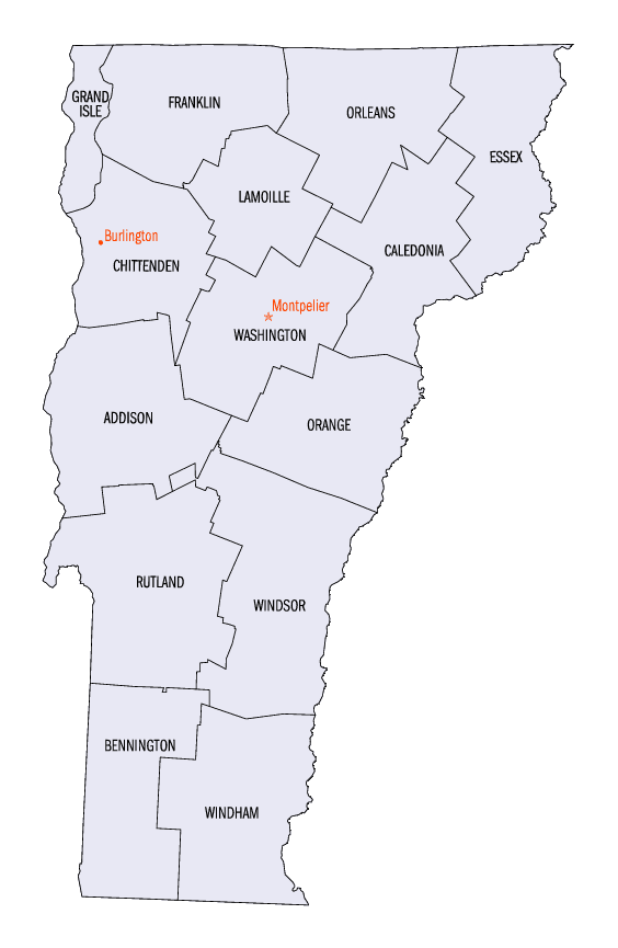
Vermont Counties
There are fourteen counties in Vermont. Each county has a county seat, known in Vermont as shire town. In 1777, Vermont had two counties. The western side of the state was called Bennington County and the eastern was called Cumberland County. In 1781 Cumberland County was broken up into three counties in Vermont, plus Washington County, which eventually became part of New Hampshire. Today's Washington County was known as Jefferson County until 1814. Essex County, Orleans County, and Caledonia County are commonly referred to as the Northeast Kingdom.Bennington County, Vermont
Bennington County Education, Geography, and History
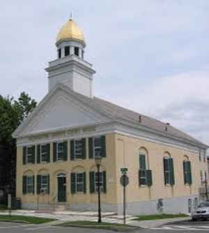
Bennington County is a county in the state of Vermont. Based on the 2010 census, the population was 37,125. The shire towns (county seats)
are Bennington (the Southshire) and Manchester (the Northshire). Its largest town is Bennington. Bennington is the oldest county in Vermont
still in existence, created by the first general assembly on 17 March 1778.
Bennington County comprises the Bennington, VT Micropolitan Statistical Area.
Etymology - Origin of Bennington County Name
For the city of Bennington, which was named for Benning Wentworth, governor of the New Hampshire Grants.
Demographics:
County QuickFacts: CensusBureau Quick Facts
Bennington County History
Established on February 11, 1779 as an original county. County Seat: Bennington. Its has the unusual distinction of having two shire towns (sometimes called county seats). Bennington is known as the South Shire & Manchester is the North Shire
Its has the unusual distinction of having two shire towns (sometimes called county seats). Bennington is known as the South Shire & Manchester is the North Shire.
In 1749, New Hampshire Governor Benning Wentworth chartered the first town in the territory now known as Vermont,
and named it Bennington, in honor of himself. The town's original settlement was formed in the area known today as
Old Bennington in 1761 by Congregational Separatists from Connecticut and Massachusetts.
The independent spirit of these early settlers was reflected in their overt resistance to land claims from New York
colony and eventually led to the formation of a local citizen militia headed by Ethan Allen, which came to be known
as the Green Mountain Boys. This militia later played a crucial role at the Battle of Bennington on August 16, 1777.
That battle was a prelude to the surrender of British General John Burgoyne at Saratoga, which led directly to the
success of the Revolution.
Bennington is the oldest county in Vermont still in existence, created by the first general assembly on 17 March 1778. Vermont was organized into two original counties, with Bennington in the west and Unity (a few days later renamed Cumberland) in the east. On 16 February 1781 Rutland County was created from Bennington County. On 13 April 1781 Bennington gained the gore east of the town of Bromley (now Peru) from Windham and Windsor Counties.
From 26 June 1781 until 23 February 1782, Vermont attempted to annex part of New York east of the Hudson River (the so-called West Union); inhabitants in the area favored Vermont's township form of government, while Vermont hoped to gain bargaining power through expansion. New York did not lose control of the area. For almost seven months Bennington County overlapped part of Albany County, New York.
On 27 February 1787 Windham County gained the town of Stratton from Bennington County, On 25 October 1805 Rutland County gained from the county when the town of Mount Tabor gained from the town of Peru. The county gained from Rutland County when the town of Dorset gained a small area from the town of Mount Tabor on 17 November 1825
Geography: Land and Water
As reported by the Census Bureau, the county has a total area of 678 square miles (1,755 km2), of which, 676 square miles (1,752 km2) of it is land and 1 square miles (4 km2) of it (0.21%) is water.
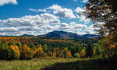
A county forming the S.W. extremity of Vermont, has an area of about 700 square miles. It is drained by the headwaters of Battenkill, Hoosick, and Deerfield rivers, and other small streams, which furnish abundant water-power. Although some good land is found within the limits of this county, a greater part of the surface is mountainous and unfitted for cultivation.
Neighboring Counties
Bordering counties are as follows:
- Rutland County, Vermont - north
- Windsor County, Vermont - northeast
- Windham County, Vermont - east
- Franklin County, Massachusetts - southeast
- Berkshire County, Massachusetts - southwest
- Rensselaer County, New York - southwest
- Washington County, New York - northwest
Education
Bennington is home to Bennington College and Southern Vermont College. The Community College of Vermont and Vermont Technical College also
have campuses in downtown Bennington.
Bennington County is home to these high schools:
Mount Anthony Union High School in Bennington
Burr & Burton Academy in Manchester
Arlington Memorial School in Arlington
Long Trail School in Dorset


Click Image to Enlarge
