

Click Image to Enlarge
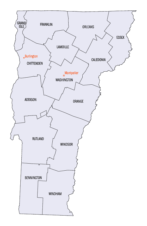
Vermont Counties
There are fourteen counties in Vermont. Each county has a county seat, known in Vermont as shire town. In 1777, Vermont had two counties. The western side of the state was called Bennington County and the eastern was called Cumberland County. In 1781 Cumberland County was broken up into three counties in Vermont, plus Washington County, which eventually became part of New Hampshire. Today's Washington County was known as Jefferson County until 1814. Essex County, Orleans County, and Caledonia County are commonly referred to as the Northeast Kingdom.Grand Isle County, Vermont
Grand Isle County Education, Geography, and History
Grand Isle County is a county located in the state of Vermont. Based on the 2010 census, the population was 6,970, making it the
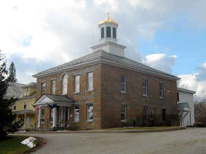
second-least populous county in Vermont. Its shire town is North Hero. The county was created in 1802 and organized in 1805.
Grand Isle County is part of the Burlington-South Burlington, VT Metropolitan Statistical Area.
Etymology - Origin of Grand Isle County Name
For the islands of Lake Champlain, which was named for the French explorer Samuel de Champlain.
Demographics:
County QuickFacts: CensusBureau Quick Facts
Grand Isle County History
Grand Isle County, Vermont, is one of several Vermont counties created from land ceded by the state of New York on
January 15, 1777 when Vermont declared itself to be a distinct state from New York. The land originally was contested by
Massachusetts, New Hampshire, and New Netherlands, but it remained undelineated until July 20, 1764 when King George III
established the boundary between New Hampshire and New York along the west bank of the Connecticut River, north of
Massachusetts and south of the parallel of 45 degrees north latitude. New York assigned the land gained to Albany
County. On March 12, 1772 Albany County was partitioned to create Charlotte County, and this situation remained until
Vermont's independence from New York and Britain. However, this did not end the contest.
On September 3, 1783, as a result of the signing of the Treaty of Paris the Revolutionary War ended with Great Britain
recognizing the independence of the United States. Vermont's border with Quebec was established at 45 degrees north
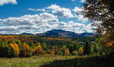
latitude, which explains why this county has no dry-land connection to the rest of the United States.
Massachusetts did not formally withdraw its claim to the region, first made in 1629, until December 16, 1786. New York,
still not satisfied with the relinquishment of its land to Vermont, asked the US Congress to arbitrate the matter.
Congress ruled against New York on March 7, 1788
Subsequently, when Vermont petitioned for Statehood, Congress ordered a joint commission to settle the border between
New York and Vermont. This commission ruled prior to Vermont's admission, which took place on March 4, 1791 but a small
change they permitted has never been acted upon
Geography: Land and Water
As reported by the Census Bureau, the county has a total area of 195 square miles (504 km2), of which, 83 square miles (214 km2) of it is land and 112 square miles (290 km2) of it (57.56%) is water.
By area, Grand Isle
County is the smallest in the state. Four of its five towns (North Hero, South Hero, Grand Isle and Isle La Motte)
are situated entirely on islands in Lake Champlain, while Alburgh is on a peninsula (known as the Alburgh Tongue)
extending south into the lake from Quebec .
Neighboring Counties
Bordering counties are as follows:
- Franklin County, Vermont - east
- Chittenden County, Vermont - south
- Clinton County, New York - west
- Le Haut-Richelieu Regional County Municipality, Quebec - north
Education


Click Image to Enlarge
