

Click Image to Enlarge
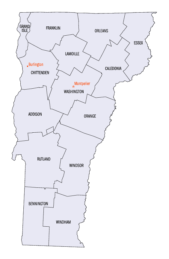
Vermont Counties
There are fourteen counties in Vermont. Each county has a county seat, known in Vermont as shire town. In 1777, Vermont had two counties. The western side of the state was called Bennington County and the eastern was called Cumberland County. In 1781 Cumberland County was broken up into three counties in Vermont, plus Washington County, which eventually became part of New Hampshire. Today's Washington County was known as Jefferson County until 1814. Essex County, Orleans County, and Caledonia County are commonly referred to as the Northeast Kingdom.Lamoille County, Vermont
Lamoille County Education, Geography, and History
Lamoille Countyis a county located in the state of Vermont. Based on the 2010 census, the population was 24,475, making it the third-least populous county in Vermont. Its shire town is Hyde Park. The county was created in 1835 and organized the following year.
Etymology - Origin of Lamoille County Name
Either for a misspelling of Champlain's intended name of Lake Champlain, or for the Old French la Moelle ("the marrow").
Demographics:
County QuickFacts: CensusBureau Quick Facts
Lamoille County History
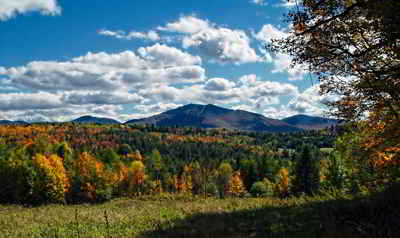
The area was buried in a mile of ice during the ice age. When it melted partially, it created Lake Stowe. When it melted completely, the water from the lake ran out through the Lamoille River valley.
Lamoille County is located in north central Vermont. The county was created in 1835 and organized the following year. Organized in 1836. Capital. Hyde Park. Population, 10,872.
Geography: Land and Water
As reported by the Census Bureau, the county has a total area of 692 square miles (1,792 km2), of which, 689 square miles (1,783 km2) of it is land and 3 square miles (8 km2) of it (0.46%) is water.
A county in the N. part of Vermont, has an area of about 450 square miles. It is intersected by the Lamoille
river, and is principally watered by it and its numerous tributaries, which afford valuable waterpower.
The Green mountain range passes through the county, on which account the soil is more adapted to grazing than
tillage, although along the Lamoille river, especially in the eastern portion, there are some excellent tracts of
rich meadow land. Indian corn, potatoes, maple sugar, unit grass are the staples. In 1850 this county produced
66,017 bushels of corn; 278,252 of potatoes; 26,973 tons of hay; 437,110 pounds of butter, and 427,918 of maple
sugar.
There were 4 woollen factories, 5 grist mills, 8 saw mills, 10 starch works, and 6 tanneries. It contained 17 churches, 4344 pupils attending
public schools, and 205 attending academies or other schools.
Neighboring Counties
Bordering counties are as follows:
- Caledonia County, Vermont - northeast
- Grafton County, New Hampshire - east
- Windsor County, Vermont - southwest
- Addison County, Vermont - west
- Washington County, Vermont - northwest
Education


Click Image to Enlarge
