

Click Image to Enlarge
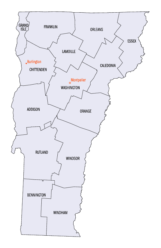
Vermont Counties
There are fourteen counties in Vermont. Each county has a county seat, known in Vermont as shire town. In 1777, Vermont had two counties. The western side of the state was called Bennington County and the eastern was called Cumberland County. In 1781 Cumberland County was broken up into three counties in Vermont, plus Washington County, which eventually became part of New Hampshire. Today's Washington County was known as Jefferson County until 1814. Essex County, Orleans County, and Caledonia County are commonly referred to as the Northeast Kingdom.Washington County, Vermont
Washington County Education, Geography, and History
Washington County is a county located in the state of Vermont, named after George Washington. Based on the 2010 census, the population was
59,534, making it the third-most populous county in Vermont, but the second-least populous capital county in the nation, after Hughes County,
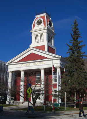
South Dakota. Its shire town is Montpelier, the state capital. The county was created in 1810 as Jefferson County and organized the following
year.
Washington County comprises the Barre, VT Micropolitan Statistical Area.
Etymology - Origin of Washington County Name
For George Washington.
Demographics:
County QuickFacts: CensusBureau Quick Facts
Washington County History
Washington County is one of several Vermont counties created from land ceded by the state of New York on January 15, 1777 when Vermont declared itself to be a distinct state from New York The land originally was contested by Massachusetts, New Hampshire, and New Netherland, but it remained undelineated until July 20, 1764 when King George III established the boundary between New Hampshire and New York along the west bank of the Connecticut River, north of Massachusetts and south of the parallel of 45 degrees north latitude. New York assigned the land gained to Albany County. On March 12, 1772 Albany County was partitioned to create Charlotte County, and this situation remained until Vermont's independence from New York and Britain.Washington County was originally established as Jefferson County in 1810 from parts of Caledonia County, Chittenden County, and Orange County. In 1814, it was renamed Washington County.
Geography: Land and Water
As reported by the Census Bureau, the county has a total area of 695 square miles (1,801 km2), of which, 689
square miles (1,785 km2) of it is land and 6 square miles (16 km2) of it (0.90%) is water.
Neighboring Counties
Bordering counties are as follows:
- Lamoille County, Vermont - north
- Caledonia County, Vermont - northeast
- Orange County, Vermont - southeast
- Addison County, Vermont - southwest
- Chittenden County, Vermont - northwest
Education


Click Image to Enlarge
