


Click Image to Enlarge
Virginia Counties
The Commonwealth of Virginia is divided into ninety-five counties and thirty-eight independent cities, which are considered county-equivalents for census purposes.Botetourt County, Virginia
Botetourt County Education, Geography, and History
Botetourt County is a county that lies in the Roanoke Region of the Commonwealth of Virginia. Located in the mountainous
portion of the state, the county is bordered by two major ranges, the Blue Ridge Mountains and the Appalachian Mountains.
Botetourt County was created in 1770 from part of Augusta County, and was named for Norborne Berkeley, known as Lord Botetourt. Like
Augusta County, Botetourt was originally a huge area; part of its land was later removed to form the entire state of Kentucky.
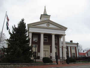
Botetourt County is part of the Roanoke Virginia Metropolitan Statistical Area, and the county seat is the town of Fincastle. Based on the 2010 census, the county population was 33,148.
Etymology - Origin of Botetourt County Name
Botetourt County was named for Norborne Berkeley, baron de Botetourt, the royal governor of Virginia from 1768 to 1770.
Demographics:
County QuickFacts: CensusBureau Quick Facts
Botetourt County History
Botetourt County, Virginia formed from Augusta and Rockbridge Counties. Legislative enactment in 1769. Organized in 1770. Rockbridge County gave only small portions at later dates (1821-1822, 1838, 1850-1851, 1887-1888 and possibly nearer the 1770 organization date as well). [Virginia Counties: Those Resulting from Virginia Legislation, by Morgan Poitiaux Robinson, originally published as Bulletin of the Virginia State Library, Volume 9, January, April, July 1916, reprinted 1992 by Genealogical Publishing Co., Inc., Baltimore, MD.]
Botetourt County was named for Norborne Berkeley, baron de Botetourt, the royal governor of Virginia from 1768 to 1770. It was formed from Augusta County in 1769, and part of Rockbridge County was added in 1785. Its area is 549 square miles, and the county seat is Fincastle.
Geography: Land and Water
As reported by the Census Bureau, the county has a total area of 546 square miles (1,410 km2), of which 541 square miles
(1,400 km2) is land and 4.7 square miles (12 km2) (0.9%) is water.
The Blue Ridge Mountains run along the eastern part of the county. The Appalachian Mountains run along the western part of the county. The
two mountain ranges come close together, separated by the town of Buchanan and the James River.
The James River originates in Botetourt County, near the village of Iron Gate, just south of the Alleghany County border by the merger of
the pristine Cowpasture River and the Jackson River. The James River runs south until Eagle Rock, where it turns east and meanders through
the county, passing Springwood and James River High School until entering Buchanan. In Buchanan, the river turns northward and flows into
Rockbridge County towards Glasgow.
Neighboring Counties
Bordering counties are as follows:
- Roanoke County, Virginia - southwest
- Craig County, Virginia - west
- Alleghany County, Virginia - northwest
- Rockbridge County, Virginia - northeast
- Bedford County, Virginia - southeast
Education
Botetourt County Public Schools operates public schools serving the county.
There are two high schools in Botetourt County. Lord Botetourt High School opened in suburban Daleville in the fall of 1959. James River
High School in Buchanan also opened in 1959.


Click Image to Enlarge
