


Click Image to Enlarge
Virginia Counties
The Commonwealth of Virginia is divided into ninety-five counties and thirty-eight independent cities, which are considered county-equivalents for census purposes.Brunswick County, Virginia
Brunswick County Education, Geography, and History
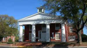
Brunswick County is a county located on the Southern border of the Commonwealth of Virginia. This rural county is known as
one the claimants to be the namesake of Brunswick stew.
Brunswick County was created in 1720, and its lands were taken from parts of Prince George, Surry and Isle of Wight counties. The county
was named for the former Duchy of Brunswick-Lunenburg, which was a British possession in the 18th century.
Based on the 2010 census, the county population was 17,434. The Brunswick county seat is Lawrenceville
Etymology - Origin of Brunswick County Name
Brunswick is named for the former Duchy of Brunswick-Lunenburg in Germany, because one of the titles also carried by Britain's Hanoverian kings was Duke of Brunswick-Lunenburg.
Demographics:
County QuickFacts: CensusBureau Quick Facts
Brunswick County History
Brunswick County, Virginia formed from Prince George, Isle of Wight, and Surry Counties. Isle of Wight and Surry only gave a small portion, possibly at a later date and possibly later another portion from Prince George County. Legislative enactment in 1720. Organized (records begin) in 1732. [Virginia Counties: Those Resulting from Virginia Legislation, by Morgan Poitiaux Robinson, originally published as Bulletin of the Virginia State Library, Volume 9, January, April, July 1916, reprinted 1992 by Genealogical Publishing Co., Inc., Baltimore, MD.]
Brunswick County was named for the duchy of Brunswick-Luneburg, one of the German possessions of George I. It was formed in 1720 from Prince GeorgeCounty, but county government was not organized until 1732. In the latter year, Brunswick County was enlarged by the addition of parts of Surry and Isle of Wight Counties. Its area is 579 square miles, and the county seat is Lawrenceville. The population is 18,419 according to the 2000 census. The first pages of a number of early record books damaged by time.
Geography: Land and Water
As reported by the Census Bureau, the county has a total area of 569 square miles (1,475 km2), of which, 566
square miles (1,466 km2) of it is land and 3 square miles (8 km2) of it (0.57%) is water.
Neighboring Counties
Bordering counties are as follows:
- Dinwiddie County, VA to the northeast
- Greensville County, VA to the east
- Lunenburg County, VA to the west
- Mecklenburg County, VA to the west
- Northampton County, NC to the southeast
- Nottoway County, VA to the northwest
- Warren County, NC to the southwest
Education


Click Image to Enlarge
