


Click Image to Enlarge
Virginia Counties
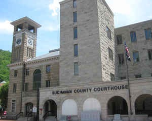
The Commonwealth of Virginia is divided into ninety-five counties and thirty-eight independent cities, which are considered county-equivalents for census purposes.Buchanan County, Virginia
Buchanan County Education, Geography, and History
Buchanan County is a county located on the western border near the far western end of the Commonwealth of Virginia. The
county is part of the Southwest Virginia region and lies in the Ridge-and-Valley portion of the Appalachian Mountains. Its county seat is
Grundy.
Buchanan County was established in 1858 from parts of Russell and Tazewell counties, and it was named in honor of former President James
Buchanan. In 1880, part of Buchanan County was taken to form Dickenson County.
Based on the 2010 census, the county population was 24,098
Etymology - Origin of Buchanan County Name
Buchanan is named for US president James Buchanan
Demographics:
County QuickFacts: CensusBureau Quick Facts
Buchanan County History
Buchanan County, Virginia formed from Russell and Tazewell Counties. [Virginia Counties: Those Resulting from Virginia Legislation, by Morgan Poitiaux Robinson, originally published as Bulletin of the Virginia State Library, Volume 9, January, April, July 1916, reprinted 1992 by Genealogical Publishing Co., Inc., Baltimore, MD.]
Buchanan County was named for the United States president James Buchanan and was formed from Tazewell and Russell Counties in 1858. Its area is 508 square miles, and the county seat is Grundy. The population is 26,978 according to the 2000 census. Buchanan is one of the Commonwealth's Burned Records Counties. County court records were destroyed by fire in 1885; records created after that date suffered extreme damage in a flood in 1977. A few re-recorded deeds exist.
Geography: Land and Water
As reported by the Census Bureau, the county has a total area of 503.8 square miles (1,304.8 km2), of which 502.7 square miles (1,302.0 km2) is land and 1.1 square miles (2.8 km2) (0.2%) is water.It is home to Poplar Gap Park.
Neighboring Counties
Bordering counties are as follows:
- Mingo County, West Virginia - north-northeast
- McDowell County, West Virginia - east
- Tazewell County, Virginia - southeast
- Russell County, Virginia - south
- Dickenson County, Virginia - southwest
- Pike County, Kentucky - northwest
Education
Colleges
Appalachian School of Law, Grundy
Appalachian College of Pharmacy, Oakwood
Private schools
Mountain Mission School, Grundy
Keen Mountain Christian Academy, Oakwood
Public high schools
All public schools in Buchanan County are operated by Buchanan County Public Schools system.
Grundy Senior High School, Grundy
Twin Valley High School, Pilgrims Knob
Council High School, Council
Hurley High School, Hurley


Click Image to Enlarge
