


Click Image to Enlarge
Virginia Counties
The Commonwealth of Virginia is divided into ninety-five counties and thirty-eight independent cities, which are considered county-equivalents for census purposes.Carroll County, Virginia
Carroll County Education, Geography, and History
Carroll County is a county located in the southwestern part of the Commonwealth of Virginia. Roughly one fifth of the county
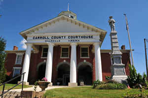
lies in the Virginia Piedmont region, while the rest is part of the Appalachian Mountains. The Carroll county seat and largest town is
Hillsville.
The county was established in 1842 from part of Grayson County, and was officially named in honor of Charles Carroll, a signer of the
Declaration of Independence. The borders of Carroll County were later expanded by including land from Patrick County.
The total size of the county is 478 square miles (1,238 km2), and, Based on the 2010 census, the population was 30,042
Etymology - Origin of Carroll County Name
Carroll is named for Charles Carroll of Carrollton, the last surviving signer of the United States Declaration of Independence
Demographics:
County QuickFacts: CensusBureau Quick Facts
Carroll County History
Carroll County, Virginia formed from Grayson and Patrick Counties. Patrick County gave only a small portion in 1855/56. [Virginia Counties: Those Resulting from Virginia Legislation, by Morgan Poitiaux Robinson, originally published as Bulletin of the Virginia State Library, Volume 9, January, April, July 1916, reprinted 1992 by Genealogical Publishing Co., Inc., Baltimore, MD.]
Carroll County was named for Charles Carroll of Carrollton, a signer of the Declaration of Independence from Maryland. It was formed from Grayson County in 1842, and part of Patrick County was added in 1856. Its area is 497 square miles, and the county seat is Hillsville.
Geography: Land and Water
It is the only county in Virginia with Piedmont topography of roughly one fifth in the southeast part of the county and mountain
topography of roughly four fifths elsewhere of the county. The Blue Ridge escarpment usually defines the county lines in both North
Carolina and Virginia. The CDP community of Cana is in the Virginia Piedmont while the rest of the county is in the Appalachian Mountains.
As reported by the Census Bureau, the county has a total area of 478 square miles (1,240 km2), of which 475 square miles (1,230 km2) is
land and 3 square miles (7.8 km2) (0.6%) is water
Neighboring Counties
Bordering counties are as follows:
- Galax, Virginia - west
- Grayson County, Virginia - west
- Wythe County, Virginia - northwest
- Pulaski County, Virginia - north
- Floyd County, Virginia - northeast
- Patrick County, Virginia - southeast
- Surry County, North Carolina - south
Education
Carroll County High School, in Hillsville, serves the county. Home of the Cavaliers, CCHS is a 9-12 comprehensive high school. The school was created by the consolidation of Woodlawn High School (Woodlawn, Virginia) and Hillsville High School (Hillsville, Virginia).


Click Image to Enlarge
