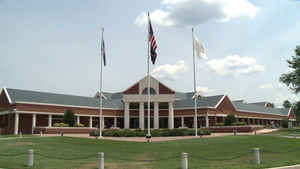
Chesterfield County, Virginia
Chesterfield County Education, Geography, and History

Chesterfield County is a county located near the state capital of Richmond in the Commonwealth of Virginia. The county
borders are primarily defined by the James River to the north, and the Appomattox River to the South. Its county seat is Chesterfield
Court House.
Based on the 2010 census, the population was 316,236. In July 2014, the population was estimated to be 330,043. Chesterfield County is part
of the greater Richmond Metropolitan Statistical Area, and much of the northern portion of the county is referred to as Metropolitan
Richmond's "South Side".
Etymology - Origin of Chesterfield County Name
Chesterfield is named for Philip Dormer Stanhope, 4th Earl of Chesterfield.
Demographics:
County QuickFacts: CensusBureau Quick Facts
Chesterfield County History
Chesterfield County formed from Henrico County. Other changes seem to have occurred from 1849-1850. [Virginia Counties: Those Resulting from Virginia Legislation, by Morgan Poitiaux Robinson, originally published as Bulletin of the Virginia State Library, Volume 9, January, April, July 1916, reprinted 1992 by Genealogical Publishing Co., Inc., Baltimore, MD.]
Chesterfield County was named for Philip Dormer Stanhope, forth earl of Chesterfield, British statesman and diplomat, and was formed from Henrico County in 1749. Its area is 446 square miles, and the county seat is Chesterfield.
Geography: Land and Water
As reported by the Census Bureau, the county has a total area of 437 square miles (1,130 km2), of which 423 square miles
(1,100 km2) is land and 14 square miles (36 km2) (3.1%) is water.
Chesterfield County is largely bordered by two rivers which define miles of its boundaries. The major adjoining cities each originated at
the head of navigation of these river, called the fall line. There, the hillier and rockier Piedmont region falls to the sandy and mostly
flat eastern coastal plain Tidewater region, a change which creates barriers for ships going upstream on the rivers. Chesterfield County
includes areas of both regions.
Richmond and Manchester were formed at the fall line of the James River. Most of the northern portion of Chesterfield County is part of
what is called Richmond's "South Side". As the James River flows east to Richmond and then turns almost due south below the fall line for
about 8 miles (13 km) before turning east, Henrico County encompasses much of Richmond's West End, North Side, and East End areas.
Chesterfield County borders on the Appomattox River to the south. Much of the southern and eastern portions of the county are considered
part of the Tri-Cities area, which includes Petersburg, located at the fall line.
Neighboring Counties
Bordering counties are as follows:
- Henrico County, Virginia - northeast
- Richmond, Virginia - northeast
- Charles City County, Virginia - east
- Hopewell, Virginia - southeast
- Prince George County, Virginia - southeast
- Colonial Heights, Virginia - southeast
- Petersburg, Virginia - southeast
- Dinwiddie County, Virginia - south
- Amelia County, Virginia - southwest
- Powhatan County, Virginia - northwest
Chesterfield County is largely bordered by two rivers which define miles of its boundaries. The major adjoining cities each originated at the head of navigation of these river, called the fall line. There, the sandy and mostly flat eastern coastal plain region of Virginia turns into the hillier and rockier Piedmont region to the west. Portions of Chesterfield County extend across both regions.
At fall line of the James River, Richmond and Manchester were formed. Most of the northern portion of
Chesterfield County accounts for what is referred to as Metropolitan Richmond's "South Side". However, due to the
geography in which the James River approaches Richmond from almost due west, and turns almost due south below the
fall line for about 8 miles (13 km) before turning east again, the land within Henrico County encompasses much of
Metropolitan Richmond's West End, its North Side, and East End areas.
Chesterfield County also borders on the Appomattox River to its south. Much of the southern and eastern portions of
the county are considered part of the Tri-Cities area, which centers on the lower Appomattox River, where the
neighboring independent city of Petersburg was founded on the fall line.
Education
Chesterfield County Public Schools is the local school system


