


Click Image to Enlarge
Virginia Counties
The Commonwealth of Virginia is divided into ninety-five counties and thirty-eight independent cities, which are considered county-equivalents for census purposes.City of Colonial Heights , Virginia
City of Colonial Heights Education, Geography, and History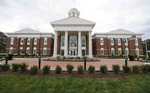
Colonial Heights is an independent city in Virginia, United States. Based on the 2010 census, the population was 17,411. The Bureau of
Economic Analysis combines the City of Colonial Heights (along with the City of Petersburg) with Dinwiddie County for statistical
purposes.
Colonial Heights is located in the Tri-Cities area of the Richmond Metropolitan Statistical Area (MSA).
Etymology - Origin of City of Colonial Heights Name
Colonial Heights, in Chesterfield County, is located on the heights overlooking the Appomattox River and takes its name from the fact that the Marquis de Lafayette placed his artillery, known as the Colonials, on the heights to shell British positions in Petersburg in 1781.
Demographics:
County QuickFacts: City of Colonial Heights
Colonial Heights City History
Colonial Heights, Virginia incorporated as a town in 1926 and as a city in 1948. [Virginia Genealogy, Sources & Resources, by Carol McGinnis, Genealogical Publishing Inc., Baltimore, MD, 1993.] Chartered as an independent city in 1928. Located in Chesterfield County, Virginia. [County Courthouse Book, by Elizabeth Petty Bentley, Genealogical Publishing Inc., Baltimore, MD, 1990.]
Like much of eastern Virginia, the site of Colonial Heights was located within the Algonquian-speaking
confederation known as Tenakomakah, ruled by Chief Powhatan, when the English colonists arrived at Jamestown on May
14, 1607. Captain John Smith's early map of Virginia testifies that the present area of Colonial Heights included
the principal town of the Appamattuck subtribe, led by their weroance, Coquonasum, and his sister, Oppussoquionuske.
In the aftermath of the Indian attacks of 1622 and 1644, they became tributary to England and relocated to nearby
Ettrick, and its opposite bank, near Fort Henry (near modern Petersburg).
What is now Colonial Heights was made part of "Henrico Cittie", one of 4 huge "incorporations" formed in the
Virginia Colony in 1619 by the London Company. English colonists first settled in the Colonial Heights area in 1620.
A small group sailed up the Appomattox River looking for clear land, and finally settled in an area where Swift
Creek runs into the Appomattox River, which they named Conjurer's Neck. This confluence was formerly the residence a
Native American healer (known as a "conjurer") who was thought to have cast spells over the waters.
Shortly thereafter, Charles Magnor registered the first land patent in the area for 650 acres, which he later
developed into a plantation before selling it in 1634. That same year, by order of King Charles I of England, the
Virginia Colony was divided into the 8 original shires of Virginia by the House of Burgesses, one of which was
Henrico County, which included the future land of Colonial Heights.
During the period from 1677 to 1685, one of the area's historic landmarks was constructed with the building of the
Brick House Farm. Richard Kennon came to Virginia prior to 1670, and became a merchant of Bermuda Hundred. He
represented Henrico County in the House of Burgesses. His son, Richard Kennon, Jr., was also a member of the House
of Burgesses and married the daughter of Col. Robert Bolling, the emigrant, and his second wife, the former Anne
Stith. Richard's sister, Mary Kennon, was married to Major John Fairfax Bolling, half-brother of Richard's wife.
Major Bolling was the son of Col. Robert Bolling and his first wife Jane Rolfe, who was granddaughter of the early
colonist John Rolfe and his Native American wife, Pocahontas. The Bollings lived at Cobb's, a plantation in eastern
Chesterfield near Point-of-Rocks.
The manor house built by Richard Kennon (later known as the "Brick House") is now thought to be the oldest permanent
structure in Colonial Heights. One wall of the house survived a disastrous fire in 1879, and the rest was rebuilt.
In 1749, an area south of the James River was divided from Henrico County by the House of Burgesses, and named
Chesterfield County. The area which became Colonial Heights was to remain in Chesterfield County for almost 200 more
years, until 1948.
The name "Colonial Heights" results from an incident during the American Revolutionary War. In 1781, the French
troops of General Marquis de Lafayette, known as the Coloniels, retreated north from Petersburg and deployed
artillery on the heights overlooking Petersburg from across the Appomattox River. The area thus came to be known as
"Colonial Heights", and the name was given to a subdivision of the Oak Hill tract in 1906.
A historic site, Oak Hill, on Carroll Avenue, also called Archer's, Hector's or Dunn's Hill, consisted of two
one-story weatherboarded structures connected by a deep inside porch that extends from an uncovered section toward
the street. From the lawn of this house, in May 1781, General Lafayette, with cannon behind a boxwood hedge that
still fringes the hill, shelled Petersburg, then occupied by the British.
The area also became involved in operations during the American Civil War. General Robert E. Lee made his
headquarters at Violet Bank from June through September during the Siege of Petersburg in 1864.
In 1926, Colonial Heights became an incorporated town in Chesterfield County. It became an independent city in 1948.
Its current charter was granted in 1960. From 1960 to 1970, Colonial Heights experienced a period of rapid growth as
the population jumped from 9,587 to 15,097.
According to Tony Horwitz's book, "Confederates in the Attic," when the Petersburg public school system was
integrated by federal order in the 1960s, most of Petersburg's white population "fled en masse across the river to a
suburb called Colonial Heights, or nicknamed 'Colonial Whites.'"
In the mid-1980s, completion of the State Route 144 (Temple Avenue Connector) and a new bridge across the Appomattox
River provided access to State Route 36 near Fort Lee. The new road and bridge effectively opened a large previously
isolated tract of land along the southeastern edge of the city for commercial development. There, the regional
Southpark Mall and many other retail businesses and offices were built.
On August 6, 1993, an F4 tornado (max. wind speeds 207-260 mph) passed through Colonial Heights. It caused extensive
damage to the Southpark Mall and collapsed the roof of a Wal Mart store, the Indian burial ground. It also did
extensive damage in Petersburg and Hopewell. In the Tri-Cities area, the tornado killed 4 people, injured 246, and
caused an estimated $50 million in property damage.
Geography: Land and Water
As reported by the Census Bureau, the city has a total area of 7.8 square miles (20.2 km2), of which,
7.5 square miles (19.4 km2) of it is land and 0.3 square miles (0.8 km2) of it (3.98%) is water.
Colonial Heights is located on just north of the Appomattox River across from the modern-day City of Petersburg at
the river's fall line It is located south of Chesterfield County (practically surrounded by it except for a south
border with Petersburg) and in some areas, Swift Creek divides the city from the county.
Neighboring Counties
Bordering counties are as follows:
- Chesterfield County, Virginia - west, north, southeast
- Petersburg, Virginia - south
- Prince George County, Virginia - east
Education
Elementary and secondary
The City of Colonial Heights is served by Colonial Heights Public Schools.
Higher education
The area is served by three schools of higher education:
Virginia State University
Richard Bland College
John Tyler Community College


Click Image to Enlarge
