


Click Image to Enlarge
Virginia Counties
The Commonwealth of Virginia is divided into ninety-five counties and thirty-eight independent cities, which are considered county-equivalents for census purposes.City of Salem, Virginia
City of Salem Education, Geography, and History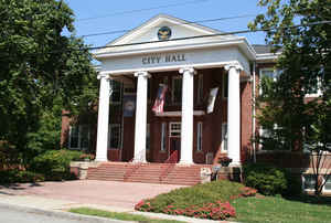
Salem is an independent city in the US commonwealth of Virginia. Based on the 2010 census, the population was 24,802. It is the county
seat of Roanoke County, although the two are separate jurisdictions. The Bureau of Economic Analysis combines the city of Salem with
Roanoke County for statistical purposes.
Salem is bordered by the city of Roanoke and is included in the Metropolitan Statistical Area.
Etymology - Origin of City of Name
The City of Salem, in Roanoke County, was laid out in 1802 on land owned by James Simpson. The town is said to have been named by a member of the Bryan family, of Salem, New Jersey.
Demographics:
County QuickFacts: City of Salem
City History
Salem is an independent city in Virginia, USA, bordered by the city of Roanoke to the east but otherwise adjacent to Roanoke County
The earliest history of Salem exists as archaeological evidence of Native American tribes as far back as 8000
B.C. until the middle of the 18th century. Europeans first explored the area of Salem in 1671, when the Totero
people had a village nearby. European explorers Thomas Batts and Robert Fallam gave the area its first recorded
name: Totero Town, after this tribe, who supplied them with a guide to help with further exploration. Fort Lewis,
named for General Andrew Lewis, of what is now Roanoke County, was constructed to the west of the town in 1752. The
city's Andrew Lewis Middle School was named after the General. Salem grew as a small settlement serving travelers on
the Great Wilderness Road (roughly the same path followed by US-11 and later Interstate 81 today) and was officially
founded in 1802, though it received its charter in 1806. It is not known with certainty why the town was named
Salem; however, the most widely accepted explanation is that Salem was named to honor William Bryan, a prominent
citizen, who had moved from Salem, New Jersey. Salem was attacked twice during the American Civil War, but its Salem
Flying Artillery was said to have fired the last Confederate shot at Appomattox Court House prior to the surrender
of Robert E. Lee. Also, one of the city's four elementary schools is named G.W. Carver. During segregation, this
school served as the high school for African Americans in Salem.
Salem annexed South Salem in 1953 and an eastern tract in 1960, giving it a population of 16,058 and thus making it
Virginia's largest town at that time. Salem officially became a city on December 31, 1967. Salem became a city to
avoid the possibility of annexation into the city of Roanoke.
Salem, Virginia established on 6 January 1806. [Virginia Genealogy, Sources & Resources, by Carol McGinnis, Genealogical Publishing Inc., Baltimore, MD, 1993.]
Salem, Virginia was incorporated as a town in 1836 and incorporated as a city in 1968. It was established on 6 January 1806. County Seat for Roanoke County, Virginia. [Virginia Genealogy, Sources & Resources, by Carol McGinnis, Genealogical Publishing Inc., Baltimore, MD, 1993.]
Geography: Land and Water
As reported by the Census Bureau, the city has a total area of 14.6 square miles (37.8 km2).
Neighboring Counties
Bordering counties are as follows:
- City of Roanoke to the east but otherwise adjacent to Roanoke County
Education


Click Image to Enlarge
