


Click Image to Enlarge
Virginia Counties
The Commonwealth of Virginia is divided into ninety-five counties and thirty-eight independent cities, which are considered county-equivalents for census purposes.Floyd County, Virginia
Floyd County Education, Geography, and History
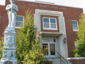
Floyd County is a county located in the Commonwealth of Virginia. Based on the 2010 census, the population was 15,279. Its county seat is
Floyd.
Floyd County is included in the Blacksburg-Christiansburg-Radford, VA Metropolitan Statistical Area.
Etymology - Origin of Floyd County Name
Floyd is named for Governor of Virginia John Floyd
Demographics:
County QuickFacts: CensusBureau Quick Facts
Floyd County History
Floyd County, Virginia formed from Montgomery and Franklin Counties. The latter apparently contributed in 1872/73. [Virginia Counties: Those Resulting from Virginia Legislation, by Morgan Poitiaux Robinson, originally published as Bulletin of the Virginia State Library, Volume 9, January, April, July 1916, reprinted 1992 by Genealogical Publishing Co., Inc., Baltimore, MD.]
Floyd County was named for John Floyd, governor of Virginia from 1830 to 1834. It was formed from Montgomery County in 1831, and part of Franklin County was added in 1873. Its area is 383 square miles, and the county seat is Floyd.
Geography: Land and Water
Floyd County has a land area of 987 square kilometers/383 square miles according to the United States Census
Bureau in the Blue Ridge Mountains of southwestern Virginia. The county seat, the town of Floyd, is 40 miles
southwest of Roanoke on US 221. Buffalo Mountain, at 3,971 feet, is the highest point in the county.
Floyd County is situated atop a high plateau of the Blue Ridge Mountains which divides the eastward flowing from the
westward flowing waters. With the high topography, no streams flow into Floyd County. The county is drained
primarily by Little River and its tributaries which flow into New River below the Claytor Lake Dam and, in turn, by
way of the Kanawha, the Ohio and the Mississippi, into the Gulf of Mexico. The headwaters of the south fork of the
Roanoke River are in the northeastern part of the county.
Neighboring Counties
Bordering counties are as follows:
- IFranklin County, Virginia - east
- Patrick County, Virginia - southeast
- Carroll County, Virginia - southwest
- Pulaski County, Virginia - northwest
- Montgomery County, Virginia - northwest
- Roanoke County, Virginia - north
Education


Click Image to Enlarge
