


Click Image to Enlarge
Virginia Counties
The Commonwealth of Virginia is divided into ninety-five counties and thirty-eight independent cities, which are considered county-equivalents for census purposes.Giles County, Virginia
Giles County Education, Geography, and History
Giles County is a county located in the state of Virginia. Based on the 2010 census, the population was 17,286.Its county seat is
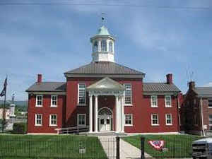
Pearisburg.
Giles County is included in the Blacksburg-Christiansburg-Radford, VA Metropolitan Statistical Area.
Etymology - Origin of Giles County Name
Giles is named for US Senator from Virginia William Branch Giles.
Demographics:
County QuickFacts: CensusBureau Quick Facts
Giles County History
Giles County, Virginia formed from Montgomery, Monroe, Tazewell, Craig, Mercer, and Wythe Counties. Montgomery, Monroe, and Tazewell appear to be original contributors with Wythe County contributing a small portion in 1823-1824. Tazewell County gave additionally from 1825-1828, 1835-1837. Monroe County contributed again from 1828-1829. Mercer County contributed in 1840-1841, 1857-1858, and 1861. Craig County contributed in 1879-1880 and 1800-1900. [Virginia Counties: Those Resulting from Virginia Legislation, by Morgan Poitiaux Robinson, originally published as Bulletin of the Virginia State Library, Volume 9, January, April, July 1916, reprinted 1992 by Genealogical Publishing Co., Inc., Baltimore, MD.]
Giles County was named for William Branch Giles, United States senator from Virginia, in 1806. It was formed from Tazewell, Monroe and Montgomery Counties. Part of Wythe County was added in 1808, parts of Tazewell County were added in 1826 and 1836, part of Monroe County was added in 1829, parts of Mercer (West Virginia) County were added in 1840-1841, and part of Craig County was added in 1858. Its area is 363 square miles, and the county seat is Pearisburg.
Geography: Land and Water
As reported by the Census Bureau, the county has a total area of 360 square miles (933 km2), of which, 357
square miles (925 km2) of it is land and 3 square miles (8 km2) of it (0.85%) is water.
Neighboring Counties
Bordering counties are as follows:
- Bland County, VA to the southwest
- Craig County, VA to the east
- Mercer County, WV to the northwest
- Monroe County, WV to the north
- Montgomery County, VA to the south
- Pulaski County, VA to the south
- Summers County, WV to the north
Education
Narrows High School (Narrows)
Giles High School (Pearisburg)


Click Image to Enlarge
