


Click Image to Enlarge
Virginia Counties
The Commonwealth of Virginia is divided into ninety-five counties and thirty-eight independent cities, which are considered county-equivalents for census purposes.Greene County, Virginia
Greene County Education, Geography, and History
Greene County is a county in central Virginia in the eastern United States. Based on the 2010 census, the population was 18,403. Its county
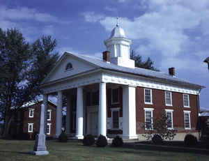
seat is Stanardsville.
Greene County is part of the Charlottesville, VA Metropolitan Statistical Area.
Etymology - Origin of Greene County Name
Greene is named for American Revolutionary War general Nathaniel Greene.
Demographics:
County QuickFacts: CensusBureau Quick Facts
Greene County History
Greene County, Virginia formed from Orange County. [Virginia Counties: Those Resulting from Virginia Legislation, by Morgan Poitiaux Robinson, originally published as Bulletin of the Virginia State Library, Volume 9, January, April, July 1916, reprinted 1992 by Genealogical Publishing Co., Inc., Baltimore, MD.]
Greene County was named for Nathanael Greene, American commander of the Army of the South in the Revolutionary War. It was formed from Orange County in 1838. Its area is 153 square miles, and the county seat is Stanardsville.
Geography: Land and Water
As reported by the Census Bureau, the county has a total area of 157 square miles (407 km2), of which, 157
square miles (406 km2) of it is land and 0 square miles (1 km2) of it (0.25%) is water.
Neighboring Counties
Bordering counties are as follows:
- Rockingham County, Virginia - west
- Page County, Virginia - northwest
- Madison County, Virginia - northeast
- Orange County, Virginia - southeast
- Albemarle County, Virginia - south
Education


Click Image to Enlarge
