


Click Image to Enlarge
Virginia Counties
The Commonwealth of Virginia is divided into ninety-five counties and thirty-eight independent cities, which are considered county-equivalents for census purposes.Henrico County, Virginia
Henrico County Education, Geography, and History
Henrico County (formerly Henrico Shire) , officially the County of Henrico, is a county located in the Commonwealth of Virginia. Based on the 2010 census, the population was 306,935. In 2014, the population was estimated to be 321,924.
Henrico County is included in the Richmond, VA Metropolitan Statistical Area.
Etymology - Origin of Henrico County Name
In 1611, Thomas Dale founded the Citie of Henricus on an island in the James River that is now called Farrar's Island. Henricus was named for Henry Frederick, Prince of Wales and was destroyed during the Indian massacre of 1622
Named after the Citie of Henricus, Henrico became one of the eight original Shires of Virginia in 1634.
Demographics:
County QuickFacts: CensusBureau Quick Facts
Henrico County History
Henrico County, Virginia formed. Original shire. [Virginia Counties: Those Resulting from Virginia Legislation, by Morgan Poitiaux Robinson, originally published as Bulletin of the Virginia State Library, Volume 9, January, April, July 1916, reprinted 1992 by Genealogical Publishing Co., Inc., Baltimore, MD.]
Henrico County is one of the eight original Shires of Virginia established in 1634 in the Virginia Colony, and one of six considered still extant in their original form (county).
The original county seat was at Varina, at the Varina Farms plantation across the James River from Henricus. John Rolfe built this
plantation, where he lived with his wife, Pocahontas. Henrico's government was located at Varina from around 1640 until 1752.
In 1752, Henrico relocated its seat to a more central location inside the city Richmond between Church Hill and what is now Tobacco Row.
The county seat remained at 22nd and Main St in Richmond even after the city's government became fully independent of the county in 1842.
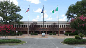
It was not until 1974 when the county moved out of the Old Henrico County Courthouse to a complex in the western portion of the county at
the intersection of Parham Road and Hungary Springs Road in Laurel.
Henrico County was named for Henry, Prince of Wales, the oldest son of James I. It was one of the eight original shires established in 1634. Its area is 244.06 square miles, and the county seat is in the western part of the county near Richmond.
Geography: Land and Water
As reported by the Census Bureau, the county has a total area of 245 square miles (634 km2).Of that, 238
square miles (617 km2) is land and 7 square miles (17 km2) (2.67%) is water
Neighboring Counties
Bordering counties are as follows:
- Richmond, Virginia - south
- Chesterfield County, Virginia - south
- Goochland County, Virginia - west
- Hanover County, Virginia - north
- New Kent County, Virginia - northeast
- Charles City County, Virginia - southeast
Education
The school division known as Henrico County Public Schools consists of 45 elementary schools, 13 middle schools, 10 high schools and 2 technical centers within one school district.


Click Image to Enlarge
