


Click Image to Enlarge
Virginia Counties
The Commonwealth of Virginia is divided into ninety-five counties and thirty-eight independent cities, which are considered county-equivalents for census purposes.Loudoun County, Virginia
Loudoun County Education, Geography, and History
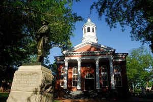
Loudoun County is a county located in the Commonwealth of Virginia. In 2014, the population was estimated to be 361,708, making it the
third-most populous county in Virginia. Loudoun's county seat is Leesburg.
Loudoun County is included in the Washington-Arlington-Alexandria, DC-VA-MD-WV Metropolitan Statistical Area.
Etymology - Origin of Loudoun County Name
Loudoun is named for John Campbell, 4th Earl of Loudoun, a colonial governor of Virginia.
Demographics:
County QuickFacts: CensusBureau Quick Facts
Loudoun County History
Loudoun County, Virginia formed from Fairfax County. Later changes occurred from 1823-1824. [Virginia Counties: Those Resulting from Virginia Legislation, by Morgan Poitiaux Robinson, originally published as Bulletin of the Virginia State Library, Volume 9, January, April, July 1916, reprinted 1992 by Genealogical Publishing Co., Inc., Baltimore, MD.]
Loudoun County was named for John Campbell, fourth earl of Loudoun, who was commander of British forces in North America during the early portion of the French and Indian War and governor of Virginia from 1756 to 1759. It was formed from Fairfax County in 1757. Its area is 512 square miles, and the county seat is Leesburg.
Geography: Land and Water
As reported by the Census Bureau, Loudoun County has a total area of 521 square miles (1,350 km2), of which,
520 square miles (1,346 km2) of it is land and 1 square miles (3 km2) of it (0.24%) is water. It is bounded on the
North by the Potomac River; across the river are Frederick and Montgomery Counties in Maryland; it is bounded on the
south by Prince William and Fauquier Counties, on the west by watershed of the Blue Ridge Mountains across which are
Jefferson County, West Virginia and Clarke County, and on the east by Fairfax County. The Bull Run Mountains and
Catoctin Mountain bisect the county. To the west of the range is the Loudoun Valley. Bisecting the Loudoun Valley
from Hillsboro to the Potomac River is Short Hill Mountain.
Neighboring Counties
Bordering counties are as follows:
- Fairfax County (east)
- Prince William County (southeast)
- Fauquier County (south)
- Jefferson County, West Virginia (west)
- Clarke County (west)
- Washington County, Maryland (northwest, across the Potomac River)
- Frederick County, Maryland (north, across the Potomac River)
- Montgomery County, Maryland (northeast, across the Potomac River)
Education
The county is served by Loudoun County Public Schools (LCPS) and Loudoun County is home to nine private schools
In terms of post-secondary education, Loudoun County is home to a variety of colleges and universities, including: Patrick Henry College;
a branch of Northern Virginia Community College in Sterling; George Washington University (satellite campus); George Mason University
(satellite campus); Marymount University (satellite campus); Shenandoah University (satellite campus); and Strayer University (satellite
campus). Loudoun is also home to the Janelia Farm Research Campus of the Howard Hughes Medical Institute.


Click Image to Enlarge
