


Click Image to Enlarge
Virginia Counties
The Commonwealth of Virginia is divided into ninety-five counties and thirty-eight independent cities, which are considered county-equivalents for census purposes.Louisa County, Virginia
Louisa County Education, Geography, and History
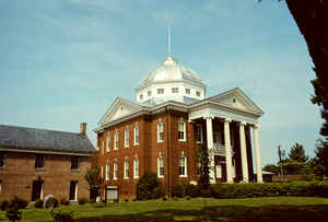
Louisa County is a county located in the Commonwealth of Virginia. Based on the 2010 census, the population was 33,153. The county seat is Louisa
Etymology - Origin of Louisa County Name
Louisa is named for Princess Louise, daughter of George II of Great Britain.
Demographics:
County QuickFacts: CensusBureau Quick Facts
Louisa County History
Louisa County, Virginia formed from Hanover County. Boundary changes seem to have continued occurring from 1836 to 1838 and again from 1876 to 1877. [Virginia Counties: Those Resulting from Virginia Legislation, by Morgan Poitiaux Robinson, originally published as Bulletin of the Virginia State Library, Volume 9, January, April, July 1916, reprinted 1992 by Genealogical Publishing Co., Inc., Baltimore, MD.]
Louisa County was named for Louisa, a daughter of George II. It was formed from Hanover County in 1742. Its area is 514 square miles, and the county seat is Louisa.
Geography: Land and Water
As reported by the Census Bureau, the county has a total area of 511 square miles (1,323 km2), of which, 497
square miles (1,288 km2) of it is land and 14 square miles (35 km2) of it (2.67%) is water.
Neighboring Counties
Bordering counties are as follows:
- Albemarle County, VA to the west
- Fluvanna County, VA to the southwest
- Goochland County, VA to the south
- Hanover County, VA to the east
- Orange County, VA to the north
- Spotsylvania County, VA to the northeast
Education


Click Image to Enlarge
