


Click Image to Enlarge
Virginia Counties
The Commonwealth of Virginia is divided into ninety-five counties and thirty-eight independent cities, which are considered county-equivalents for census purposes.Patrick County, Virginia
Patrick County Education, Geography, and History
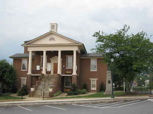
Patrick County is a county located in the Commonwealth of Virginia. Based on the 2010 census, the population was 18,490. Its county seat is Stuart. It is located within both the rolling hills and valleys of the Piedmont Region of Virginia and mountainous Southwest Virginia.
Etymology - Origin of Patrick County Name
Patrick is named for American Revolutionary Patrick Henry.
Demographics:
County QuickFacts: CensusBureau Quick Facts
Patrick County History
Patrick County was formed in 1791, when Patrick Henry County was divided into Patrick County and Henry County. Patrick Henry County was
named for Patrick Henry, and was formed in 1777.
Prior to the formation of Patrick County, one of the Virginia colony's first frontier forts lay within the boundaries of what was then
Halifax County on the banks of the North Mayo River. The location of Fort Mayo, now marked by a Virginia state historic marker, lies
within present-day Patrick County. It was one of a number of such forts built from the Potomac River south to North Carolina, and was
commanded by Captain Samuel Harris in 1756, the year in which George Washington made a tour of Fort Mayo and several other forts on the
Virginia frontier. Fort Mayo was the southernmost of the Virginia frontier forts and saw action during the French and Indian War.
One of Patrick County's most prominent early settlers was Col. Abraham Penn (sometimes written Abram Penn), born in 1743 in what is today
Amherst County, Virginia. Penn qualified as Lieutenant in the Amherst County militia in June 1768, and led a company under Col. Andrew
Lewis at the Battle of Point Pleasant in 1774. Penn later moved with his wife Ruth (née Stovall) to present-day Henry County, Virginia,
where he patented lands at the later site of Beaver Creek Plantation. Penn served on the Committee of Safety for both Henry and
Pittsylvania counties, and as a delegate to the Virginia General Assembly from Henry County
Patrick County, Virginia formed from Henry County. Legislative enactment in 1790. Organized in 1791. [Virginia Counties: Those Resulting from Virginia Legislation, by Morgan Poitiaux Robinson, originally published as Bulletin of the Virginia State Library, Volume 9, January, April, July 1916, reprinted 1992 by Genealogical Publishing Co., Inc., Baltimore, MD.]
Patrick County, like Henry County, was named for Patrick Henry. It was formed from Pittsylvania and Henry County in 1790. Its area is 469 square miles, and the county seat is Stuart.
Geography: Land and Water
As reported by the Census Bureau, the clllounty has a total area of 486 square miles (1,258 km2), of which,
483 square miles (1,251 km2) of it is land and 3 square miles (7 km2) of it (0.56%) is water.
Neighboring Counties
Bordering counties are as follows:
- Carroll County, Virginia - west
- Floyd County, Virginia - northwest
- Franklin County, Virginia - northeast
- Henry County, Virginia - east
- Stokes County, North Carolina - south
- Surry County, North Carolina - southwest
Education
Patrick County Public Schools has seven total public schools, of which four are for grades K-7, one is for grades K-3, one is for grades 4-7, and Patrick County High School is for grade 8-12


Click Image to Enlarge
