


Click Image to Enlarge
Virginia Counties
The Commonwealth of Virginia is divided into ninety-five counties and thirty-eight independent cities, which are considered county-equivalents for census purposes.Powhatan County, Virginia
Powhatan County Education, Geography, and History
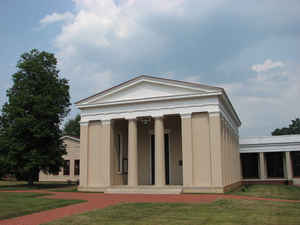
Powhatan County is a county located in the Commonwealth of Virginia. Based on the 2010 census, the population was 28,046. Its county seat is
Powhatan.
Powhatan County is included in the Richmond, VA Metropolitan Statistical Area.
Etymology - Origin of Powhatan County Name
Powhatan is named for Wahunsunacock, called Powhatan.
Demographics:
County QuickFacts: CensusBureau Quick Facts
Powhatan County History
In May 1777, the Virginia General Assembly created Powhatan County out of land from the eastern portion of Cumberland County between
the Appomattox and James rivers. Residents named the county in honor of Chief Powhatan, paramount chief of the Powhatan Confederacy. He
had allied with Algonquian-speaking tribes in the Tidewater, numbering about 30,000 in population at the time of the Jamestown settlement.
He was also the father of Pocahontas, whom colonists perceived as friendly. While in captivity, she accepted Christianity and married
English settler John Rolfe. Many of their descendants were counted among the First Families of Virginia.
For the first two years after the county was formed, Mosby Tavern served as the Powhatan County courthouse. When a new courthouse was
built in 1778, the immediate area was named "Scottville" after General Charles Scott, a Revolutionary War soldier. He was later elected
governor of the Commonwealth of Kentucky after it was formed in 1792 as a separate state from land ceded by Virginia. The courthouse area
was later named Powhatan
Powhatan County, Virginia formed from Cumberland and Chesterfield Counties. Chesterfield gave only a small portion in 1849-50. [Virginia Counties: Those Resulting from Virginia Legislation, by Morgan Poitiaux Robinson, originally published as Bulletin of the Virginia State Library, Volume 9, January, April, July 1916, reprinted 1992 by Genealogical Publishing Co., Inc., Baltimore, MD.]
Powhatan County was named for the Indian chieftain who ruled the native inhabitants of tidewater Virginia in the early seventeenth century. It was formed from Cumberland County in 1777, and part of Chesterfield County was added later. Its area is 272 square miles, and the county seat is Powhatan.
Geography: Land and Water
As reported by the Census Bureau, the county has a total area of 262 square miles (680 km2), of which, 261
square miles (677 km2) of it is land and 1 square miles (3 km2) of it (0.43%) is water.
Neighboring Counties
Bordering counties are as follows:
- Amelia County, VA to the south
- Chesterfield County, VA to the southeast
- Cumberland County, VA to the west
- Goochland County, VA to the north
- Henrico County, VA to the east
Education


Click Image to Enlarge
