


Click Image to Enlarge
Virginia Counties
The Commonwealth of Virginia is divided into ninety-five counties and thirty-eight independent cities, which are considered county-equivalents for census purposes.Pulaski County, Virginia
Pulaski County Education, Geography, and History
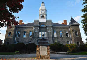
Pulaski County is a county located in the state of Virginia. Based on the 2010 census, the population was 34,872. Its county seat is
Pulaski.
Pulaski County is part of the Blacksburg–Christiansburg–Radford, VA Metropolitan Statistical Area.
Etymology - Origin of Pulaski County Name
Pulaski is named for Kazimierz Pulaski, Polish military strategist who assisted the Continental Army during the American Revolutionary War.
Demographics:
County QuickFacts: CensusBureau Quick Facts
Pulaski County History
Pulaski County was formed on March 30, 1839 from parts of Montgomery and Wythe counties, becoming the 87th county of the Commonwealth of Virginia. It was named for Count Casimir Pulaski, who fought during the American Revolution as part of George Washington's army. Pulaski had been a nobleman in Poland, but had been exiled. He joined the army in 1777 and became a brigadier general and chief of cavalry in the Continental Army. He was fatally wounded at Savannah and died on October 11, 1779. Casimir Pulaski is one of the most honored American heroes in terms of places and events named in his honor.
Pulaski County, Virginia formed from Montgomery and Wythe Counties. Wythe County also contributed a small portion between 1861 and 1862. [Virginia Counties: Those Resulting from Virginia Legislation, by Morgan Poitiaux Robinson, originally published as Bulletin of the Virginia State Library, Volume 9, January, April, July 1916, reprinted 1992 by Genealogical Publishing Co., Inc., Baltimore, MD.]
Pulaski County was named for Casimir Pulaski, the Polish patriot who served in the American army during the revolutionary war and who was killed during the siege of Savannah in 1779. It was formed from Montgomery and Wythe counties in 1839. Its area is 333 square miles, and the county seat is Pulaski.
Geography: Land and Water
As reported by the Census Bureau, the county has a total area of 330 square miles (854 km2), of which, 321
square miles (830 km2) of it is land and 9 square miles (23 km2) of it (2.74%) is water.
Pulaski County is the site of Claytor Lake State Park, which is located on Claytor Lake, a 4,500 acre, 21-mile long
man made lake on the New River created for a hydroelectric project of Appalachian Power Company. It is named for W.
Graham Claytor (1886-1971) of Roanoke, Virginia, a vice president of Appalachian Power and supervised construction
of the dam and creation of the lake.
Neighboring Counties
Bordering counties are as follows:
- Bland County, Virginia - northwest
- Giles County, Virginia - north
- Montgomery County, Virginia - northeast
- Radford, Virginia - northeast
- Floyd County, Virginia - southeast
- Carroll County, Virginia - south
- Wythe County, Virginia - southwest, west
Education


Click Image to Enlarge
