


Click Image to Enlarge
Virginia Counties
The Commonwealth of Virginia is divided into ninety-five counties and thirty-eight independent cities, which are considered county-equivalents for census purposes.Rappahannock County, Virginia
Rappahannock County Education, Geography, and History
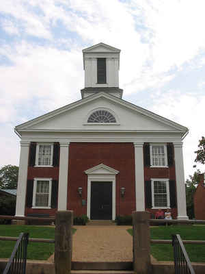
Rappahannock County is a county located in the Commonwealth of Virginia. Based on the 2010 census, the population was 7,373. Its county seat
is Washington. The name "Rappahannock" comes from the Algonquian word lappihanne (also noted as toppehannock), meaning "river of quick,
rising water" or "where the tide ebbs and flows."
Rappahannock County is included in the Washington-Arlington-Alexandria, DC-VA-MD-WV Metropolitan Statistical Area.
Etymology - Origin of Rappahannock County Name
Rappahannock is named for the Rappahannock River, named in turn for the Rappahannock Native American people
Demographics:
County QuickFacts: CensusBureau Quick Facts
Rappahannock County History
Rappahannock County was founded by an act of the Virginia General Assembly in 1833, based on the growing population's need to have better access to a county seat. The county's land was carved from Culpeper County. Rappahannock county was named for the river that separates it from Fauquier County.
Rappahannock County, Virginia formed from Culpeper County. [Virginia Counties: Those Resulting from Virginia Legislation, by Morgan Poitiaux Robinson, originally published as Bulletin of the Virginia State Library, Volume 9, January, April, July 1916, reprinted 1992 by Genealogical Publishing Co., Inc., Baltimore, MD.]
Rappahannock County was named for the Rappahannock River, which in turn received its name from an Indian tribe that lived along its banks. There have been two Virginia counties named Rappahannock. The first was created from Lancaster in 1656 and became extinct in 1692 when it was divided into Essex and Richmond counties. The present county was formed from Culpeper County in 1833. Its area is 267 square miles, and the county seat is Washington.
Geography: Land and Water
The Rappahannock River forms the northeastern boundary and separates Rappahannock County from Fauquier County.
Rappahannock County is bounded on the southeast by Culpeper County and on the southwest by Madison County. The Blue
Ridge Mountains occupy much of the western portion of the county.
As reported by the Census Bureau, the county has a total area of 267 square miles (691 km2), of which, 267 square
miles (690 km2) of it is land and 0 square miles (1 km2) of it (0.10%) is water.
Neighboring Counties
Bordering counties are as follows:
- Warren County, Virginia - northwest
- Fauquier County, Virginia - northeast
- Culpeper County, Virginia - southeast
- Madison County, Virginia - southwest
- Page County, Virginia - west
Education
The Rappahannock County Public Schools School District is located in Washington, VA and includes two schools that serve 921 students
county-wide in grades PK through 12.
Among the private schools in the county are two pre-K thru 12 schools, Hearthstone School , and Wakefield Country Day School.there is one
6 thru 12 school, Belle Meade Farm School.


Click Image to Enlarge
