


Click Image to Enlarge
Virginia Counties
The Commonwealth of Virginia is divided into ninety-five counties and thirty-eight independent cities, which are considered county-equivalents for census purposes.Spotsylvania County, Virginia
Spotsylvania County Education, Geography, and History
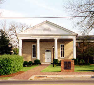
Spotsylvania County is a county in the state of Virginia. As of the 2015 estimate, the population was 130,674. Its county seat is
Spotsylvania Courthouse.
Spotsylvania County is a part of Northern Virginia and is a part of the Washington-Arlington-Alexandria, DC-VA-MD-WV Metropolitan
Statistical Area.
Etymology - Origin of Spotsylvania County Name
Spotsylvania is named for Alexander Spotswood, a lieutenant governor of Virginia during the colonial period
Demographics:
County QuickFacts: CensusBureau Quick Facts
Spotsylvania County History
At the time of European encounter, the inhabitants of the area that became Spotsylvania County were a Siouan-speaking tribe called the
Manahoac.
Spotsylvania County was established in 1721 from Essex, King and Queen, and King William counties. The county was named in Latin for
Lieutenant Governor of Virginia Alexander Spotswood.
Spotsylvania County, Virginia formed from Essex, King and Queen, and King William Counties. Legislative enactment in 1720. Organized in 1721. [Virginia Counties: Those Resulting from Virginia Legislation, by Morgan Poitiaux Robinson, originally published as Bulletin of the Virginia State Library, Volume 9, January, April, July 1916, reprinted 1992 by Genealogical Publishing Co., Inc., Baltimore, MD.]
Spotsylvania County was named for Alexander Spotswood, lieutenant governor of Virginia from 1710 to 1722. It was formed from Essex, King and Queen and King William counties in 1720. Its area is 409 square miles, and the county seat is Spotsylvania.
Geography: Land and Water
As reported by the Census Bureau, the county has a total area of 412 square miles (1,068 km2), of which, 401
square miles (1,038 km2) of it is land and 11 square miles (30 km2) of it (2.77%) is water.
It is bounded on the north by the Rappahannock and Rapidan rivers and the independent city of Fredericksburg and the
counties of Stafford and Culpeper; on the south by the North Anna River and its impoundment, Lake Anna, and by the
counties of Hanover and Louisa; on the west by Orange County and Culpeper County; and on the east by Caroline
County.
Neighboring Counties
Bordering counties are as follows:
- Culpeper County, Virginia - north
- Stafford County, Virginia - northeast
- Fredericksburg, Virginia - northeast
- Caroline County, Virginia - southeast
- Hanover County, Virginia - south
- Louisa County, Virginia - southwest
- Orange County, Virginia - west and northwest
Education
Public schools
Spotsylvania County Public Schools is a public school district serving Spotsylvania County, Virginia. It consists of 17 Elementary, 7 Middle, and 5 High Schools
Private schools
Fredericksburg Academy, Fredericksburg Christian School, Odyssey Montessori School, Saint Patrick School, Saint Michael the Archangel High School, and Faith Baptist Christian School are private schools that serve the area.
Colleges and universities
Germanna Community College is part of the Virginia Community College System and serves the City of Fredericksburg, and the counties of
Stafford, Spotsylvania, Orange, Culpeper, and King George.
The University of Mary Washington located in nearby Fredericksburg, Virginia, is a four-year university and graduate school that also
serves the area.


Click Image to Enlarge
