


Click Image to Enlarge
Virginia Counties
The Commonwealth of Virginia is divided into ninety-five counties and thirty-eight independent cities, which are considered county-equivalents for census purposes.Wythe County, Virginia
Wythe County Education, Geography, and History
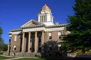
Wythe County is a county located in the state of Virginia. Based on the 2010 census, the population was 29,235. Its county seat is Wytheville
Etymology - Origin of Wythe County Name
Wythe is named for Founding Father George Wythe.
Demographics:
County QuickFacts: CensusBureau Quick Facts
Wythe County History
Wythe County was formed from Montgomery County in 1790. It was named after George Wythe, the first Virginian signer of the Declaration
of Independence. During the Civil War the Battle of Cove Mountain was fought in the county.
Prior to Wythe County's creation, what is now the Wythe County community of Austinville served as the county seat for Fincastle County, an
extinct Virginia county whose borders stretched from Roanoke, Virginia, to the Mississippi River – a county roughly the size of half the
State of Texas.
Wythe County, Virginia formed from Montgomery and Grayson Counties. Legislative enactment in 1789. Organized in 1790. Grayson County gave only small portions in 1824-1826, 1831-1832, 1839-1841, 1861-1862, and 1874-1875. [Virginia Counties: Those Resulting from Virginia Legislation, by Morgan Poitiaux Robinson, originally published as Bulletin of the Virginia State Library, Volume 9, January, April, July 1916, reprinted 1992 by Genealogical Publishing Co., Inc., Baltimore, MD.]
Wythe County was named for George Wythe, a signer of the Declaration of Independence and chancellor of Virginia in 1789 when Wythe County was formed from Montgomery County. Part of Grayson County was added in 1825. Its area is 463 square miles, and the county seat is Wytheville.
Geography: Land and Water
As reported by the Census Bureau, the county has a total area of 465 square miles (1,203 km2), of which,
463 square miles (1,200 km2) of it is land and 1 square miles (4 km2) of it (0.29%) is water.
Neighboring Counties
Bordering counties are as follows:
- Bland County, VA to the north
- Carroll County, VA to the south
- Grayson County, VA to the south
- Pulaski County, VA to the east
- Smyth County, VA to the west
Education
Colleges
Breckbill Bible College, Grahams Forge
Blueridge College of Evangelism, Wytheville
Wytheville Community College, Wytheville
Public high schools
Fort Chiswell High School, Fort Chiswell
George Wythe High School, Wytheville
Rural Retreat High School, Rural Retreat


Click Image to Enlarge
