


Click Image to Enlarge
Arkansas Counties
The first of the Arkansas' seventy-five present-day counties created, Arkansas County was formed on 13 December 1813, when this area was part of the Missouri Territory.Carroll County, Arkansas
Carroll County Education, Geography, and History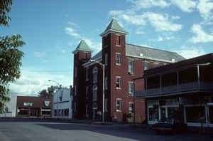
Carroll County is a county located in the state of Arkansas. Based on the 2010 census, the population was 27,446. The county has two county seats, Berryville and Eureka Springs. Carroll County is Arkansas's 26th county, formed on November 1, 1833 Carroll county is named after Charles Carroll of Carrollton, the last surviving signer of the United States Declaration of Independence.
Etymology - Origin of Carroll County Name
Carroll county is named for Charles Carroll of Carrollton, a signer of the United States Declaration of Independence from Maryland who was the last surviving and only Catholic signer. Charles Carroll of Carrollton (September 19 1737 - November 14 1832) was a delegate to the Continental Congress and later United States Senator for Maryland. He was the only Catholic signer of the Declaration of Independence. He was the longest lived signer of the Declaration of Independence and the Continental Congress, dying at the age of 95.
Demographics:
County QuickFacts: CensusBureau Quick Facts
Carroll County History
Carroll county was formed on November 1, 1823, and named for Charles Carroll, a signer of the Declaration of Independence from Maryland. A fast-growing county, last census, (1990), showed a 15.1% increase in population. Poultry growing and processing has become the number one economic activity with tourism and beef production close behind. Carroll County has dual county seats, Berryville, an old fashion town square, is surrounded by shops, restaurants and museums, and Eureka Springs, called "Little Switzerland." Victorian cottages cling to the hillsides; steep winding streets never cross at right angles. Some of the finest artists live and work in the county. Beaver and Table Rock Lakes offer fishing, boating, swimming and other water sports. Shopping in the area shops is popular for all ages. The Eureka Springs courthouse is located on the winding main street that is lined with hotels and shops.
Geography: Land and Water
As reported by the Census Bureau, the county has a total area of 639 square miles (1,660 km2), of which 630 square miles (1,600 km2) is land and 8.7 square miles (23 km2) (1.4%) is water.
Carroll county has flat-topped mountains covered with upland forests of oak and hickory, known as the Ozark Mountain Region. Some of the most spectacular scenery in the Ozarks is found here. Forest, meadows, limestone bluffs, and springs are breath taking. Table Rock and Beaver Lakes offer fishing, boating, swimming and other water sports.
Neighboring Counties
Bordering counties are as follows:
- North: Stone County, Mo.
- Northeast: Taney County, Mo.
- East: Boone County
- Southeast: Newton County
- Southwest: Madison County
- West: Benton County
- Northwest: Barry County, Mo.
Education


Click Image to Enlarge
