


Arkansas State Almanac: Facts and Figures
Quick Facts, Figures, and Overview of the State of Arkansas
Arkansas is one of the West South Central states of the US. The name of the Arkansas name originated from the Quapaw indigenous tribes living in that area. Arkansas (AR) has common boundaries with six American states and they are Missouri, Tennessee, Louisiana, Mississippi, Texas, and Oklahoma. Group of Indians known as the Quapaws lived in what is now northern Arkansas. Indians of the Ohio Valley referred to the Quapaws as the Arkansas, or "South Wind," thus the origin of Arkansas name.
Arkansas is known as an agricultural state with diverse mineral resources, Arkansas by the 1990s had an economy that was dominated by mining and manufacturing. Tourism is promoted, especially by the mineral springs at Hot Springs National Park and resorts in the Ozark Mountains. Food products are the state's largest employing sector, with lumber and wood products a close second. Arkansas is also a leader in the production of cotton, rice, and soybeans. It also has the country's only active diamond mine; located near Murfreesboro, it is operated as a tourist attraction.
Arkansas Almanac:
|
|||
|---|---|---|---|
| Official Name | Arkansas | ||
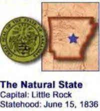
| Capital | Little Rock | ||
| Nicknames | The Natural State (Official) ...and more | ||
| Motto | Regnat Populus (The people rule) | ||
| Location Region |
34.72240 N, 092.35407 W Southern Southwestern |
||
| Constitution Ratified | 1874 | ||
| Statehood | June 15, 1836 25th State |
||
| Population | 2,915,918 (2010) 51.34 sq. mi. 33rd |
||
| Largest City (by population) |
10 largest cities (2010): Little Rock, 193,524; Fort Smith, 86,209; Fayetteville, 73,580; Springdale, 69,797; Jonesboro, 67,263; North Little Rock, 62304; Conway, 58,908; Rogers, 55,964; Pine Bluff, 49,083; Bentonville, 35,301 | ||
| Bordering States | North and North East: Missouri East: Tennessee and Mississippi (Mississippi River forms virtually the entire Eastern boundary) South: Louisiana South West: Texas West: Oklahoma |
||
| Major Industry | agriculture (chickens, soybeans, rice, cotton), paper and wood products (including furniture), electronic equipment, mining (aluminum and diamonds) | ||
| Major Rivers | Arkansas River, Mississippi River | ||
| Major Lakes | Lake Ouachita, Bull Shoals Lake | ||
| Arkansas Counties | 75 Counties in Arkansas | ||
| Largest County (by population) |
Pulaski County 366,463 (2005) 843 sq. mi. |
||
| Largest County (by area) |
Union County 1,039 sq. mi. |
||
| State parks | 51 | ||
| Presidential Birthplace | William Jefferson Clinton was born in Hope on August 19, 1946 (he was the 42nd US President, serving from 1993 to 2001). | ||
| Electoral Votes | 6 | ||
| US Congress | 2 Senators; 4 Representatives | ||
| Time Zone | Central Standard Time | ||
| Zip Codes | NANPA | ||
| State Quick Facts | Census Bureau Quick Facts | ||
Arkansas Climate and Weather |
|
|---|---|
|
The weather in Arkansas is mild and typically pleasant. No matter what time of year you plan on visiting Arkansas, you'll find The Natural State offering beautiful scenic views and plenty of opportunities for outdoor adventure. With four distinct, yet temperate, seasons, Arkansas is the perfect year-round vacation destination. Spring and fall are particularly mild with the most extreme temperatures occurring in late summer when days are hot and humid and during winter months when temperatures occasionally dip into the teens or below. The Arkansas weather forecast often changes dramatically due to surrounding weather influences. When two or more weather systems merge, clouds form, temperature changes and precipitation often follows. Arkansas's central location allows weather systems from all directions to influence its climate. |
|
| Highest Temperature | 120 degrees Aug. 10, 1936 - Ozark |
| Lowest Temperature | -29 degrees Feb. 13, 1905 - Pond |
| Avg. Temp: High - Low |
93.6 degrees 26.6 degrees |
Arkansas Points of Interest |
|
| Numerous Civil War battlefields, Hot Springs National Park and Buffalo National River in the Ozarks are major state attractions, Crater of Diamonds State Park, Mammoth Spring State Park, the Ozark Mountains, Blanchard Springs Caverns, the Historic Arkansas Museum at Little Rock, the William J. Clinton Birthplace in Hope, and the Arkansas Folk Center in Mountain View, and the State Capital in Little Rock to name but a few. New in 2011 is the Crystal Bridges Museum for American Art, designed by Moshe Safdie, which houses the collection of Walmart heiress Alice Walton. | |
Arkansas Highest, Lowest, and Mean Elevations (Feet) |
|
| Mean Elevation: 650 feet | |
| Highest Point: Magazine Mountain: 2,753 feet
|
|
| Lowest Point: | Ouachita River 55 feet |
Arkansas Land Area (Square Miles) |
|
| Geographic Center | In Pulaski County, 12 mi. SW of Little Rock Longitude: 92° 18.1'W Latitude: 34°48.9'N |
| Total Area | 53,178.62 sq. mi. 29th |
| Land Area | 52,068.17 sq. mi. 97.92% |
| Water Area | 1,110.45 sq. mi. 2.08% |
| Forested Land Area | 56.4% |
| Dimensions (Length - Width) |
260 miles - 240 miles |
| Source:(US Census, April 1, 2000) | |
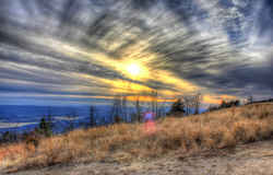 At 2,753 feet, Mount Magazine
is Arkansas's highest mountain. Signal Hill and the Greenfield and East End picnic areas are near the summit of this plateau-like mountain. From
Cameron Bluff, the trail winds down the mountain to a broad bench where virgin oak, gum and ash are found. This trail is listed in both the day and
overnight hiking sections due to the versatility offered by the variety of access points, distances, and terrain. This is truly a unique mountain
setting, offering some of the most expansive views in Arkansas.
At 2,753 feet, Mount Magazine
is Arkansas's highest mountain. Signal Hill and the Greenfield and East End picnic areas are near the summit of this plateau-like mountain. From
Cameron Bluff, the trail winds down the mountain to a broad bench where virgin oak, gum and ash are found. This trail is listed in both the day and
overnight hiking sections due to the versatility offered by the variety of access points, distances, and terrain. This is truly a unique mountain
setting, offering some of the most expansive views in Arkansas.Arkansas, Ashley, Baxter, Benton, Boone, Bradley, Calhoun, Carroll, Chicot, Clark, Clay, Cleburne, Cleveland, Columbia, Conway, Craighead, Crawford, Crittenden, Cross, Dallas, Desha, Drew, Faulkner, Franklin, Fulton, Garland, Grant, Greene, Hempstead, Hot Spring, Howard, Independence, Izard, Jackson, Jefferson, Johnson, Lafayette, Lawrence, Lee, Lincoln, Little River, Logan, Lonoke, Madison, Marion, Miller, Mississippi, Monroe, Montgomery, Nevada, Newton, Ouachita, Perry, Phillips, Pike, Poinsett, Polk, Pope, Prairie, Pulaski, Randolph, Saline, Scott, Searcy, Sebastian, Sevier, Sharp, St. Francis, Stone, Union, Van Buren, Washington, White, Woodruff, Yell

