


Click Image to Enlarge
Kentucky Counties
Kentucky has one hundred and twenty counties, third in the US behind Texas's (254) and Georgia's (159.) Washington County was the first county formed in the Commonwealth of Kentucky when it reached statehood, and the sixteenth county formedMeade County, Kentucky
Meade County Education, Geography, and History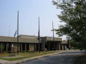
Meade County is a county located in the state of Kentucky. Based on the 2010 census, the
population was 28,602. Meade County was created
on December 17, 1823. The county seat is
Brandenburg. The county is named for Captain James M. Meade, who was killed in action at the Battle of River
Raisin during the War of 1812.
Meade County is part of the Elizabethtown-Fort Knox, KY Metropolitan Statistical Area, which is included in the Louisville/Jefferson
County-Elizabethtown-Madison, KY-IN Combined Statistical Area.
Etymology - Origin of Meade County Name
Meade county is named for Captain James Meade (?-1813), hero in the War of 1812. One of those honored after the Battle of River Raisin.
Demographics:
County QuickFacts: CensusBureau Quick Facts
Meade County History
Meade county was formed in 1824. It is located in the Pennyrile region of the state. In 2000 the county population was 26,349 in a land area of 308.51 square miles, an average of 85.4 people per square mile. The county seat is Brandenburg.
Meade County, the 76th county in Kentucky, was established by Legislative action December 17, 1823 from both Hardin
and Breckinridge counties and was named in honor of Captain James M. Meade. It is bounded north and northeast for a
great length by the Ohio River, east by Hardin, south by Hardin and Breckinridge County.
Early settlers arrived in the Wolf Creek Area around 1785, but the first permanent settlements were Hill Grove, Stith's
Valley, Doe Run Creek and Otter Creek in 1792. There was an abundance of game for food but the Indians were a problem
making it necessary to build solid stockades. Land was cleared and planted. Grinding mills were built on Doe Run and
Otter Creeks using the fast flowing creeks as power for the mills. The first mill (Lincoln's father was the stonemason)
on Doe Run Creek is now an Inn featuring Kentucky foods. Small distilleries dotted the county as apple and peach
orchards thrived in the area. Meade County's apple brandy was reputed to be the best in the world.
Meade County is well-watered with streams such as Otter, Doe, Wolf, and Spring Creeks. Topographically, Meade County is
made up of "barrens" as well as gently rolling river bottoms. The soil is clay with an abundance of limestone and
fertile nature. Tobacco and corn have been leading crops throughout the years, as well as the raising of livestock,
grains, etc. in the farmers livelihood.
Brandenburg, is the county seat, situated along the Ohio River, 40 miles below Louisville. It was named for Colonel
Solomon Brandenburg and became incorporated in 1825. Circa 1870, the population stood at 427.
Geography: Land and Water
As reported by the Census Bureau, the county has a total area of 325 square miles (840 km2), of which 305 square miles (790 km2) is land and 19 square miles (49 km2) (5.9%) is water.
Meade county is located close to the center of Kentucky. The
entire 56 miles of the county's northern border with Indiana face the Ohio River.
The elevation in the county ranges from 383 to 1000 feet above sea
level.
Neighboring Counties
Bordering counties are as follows:
- Northeast: Harrison County, Ind.
- Southeast: Hardin County
- Southwest: Breckinridge County
- Northwest: Perry County, Ind.; Crawford County, Ind.
Education


Click Image to Enlarge
