


Kentucky State Almanac: Facts and Figures
Quick Facts, Figures, and Overview of the State of Kentucky
Kentucky is officially Commonwealth of Kentucky, one of the East South Central states of the US. Kentucky is part of Appalachia. Kentucky borders seven states, from the Midwest and the Southeast. West Virginia lies to the east, Virginia to the southeast, Tennessee to the south, Missouri to the west, Illinois and Indiana to the northwest, and Ohio to the north and northeast. Only Missouri and Tennessee, both of which border eight states, touch more states. Kentucky's name comes from the Wyandot Indian name for "plain" in reference to the central plains of the state.
Kentucky was mainly a farming state until the mid-20th century, when services and manufacturing became the leading economic activities. Kentucky prides itself on producing some of the nation's best tobacco, horses, and whiskey. Corn, soybeans, wheat, fruit, hogs, cattle, and dairy products are among the agricultural items produced.
Among the manufactured items produced in the state are motor vehicles, furniture, aluminum ware, brooms, apparel, lumber products, machinery, textiles,
and iron and steel products. Kentucky also produces significant amounts of petroleum, natural gas, fluorspar, clay, and stone. However, coal accounts
for 85% of the total mineral income.
Kentucky Almanac: Facts on the State of Kentucky |
|||
|---|---|---|---|
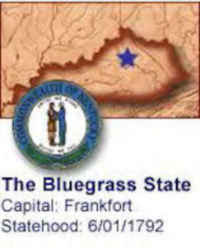
| Official Name | Kentucky | ||
| Capital | Frankfort | ||
| Nicknames | Bluegrass State ... and more | ||
| Motto Motto Latin |
"United we stand, divided we shall fall" "Deo gratiam habeamus" |
||
| Location Region |
38.19077 N, 084.86520 W Appalachia Southern |
||
| Constitution Ratified | 1891 | ||
| Statehood | June 01, 1792 15th state |
||
| Population | 4,339,367 (2010) 101.73 sq. mi. 25th |
||
| Largest City (by population) |
10 largest cities (2010):Louisville/Jefferson County,1 566,503; Lexington-Fayette,2 295,803; Bowling Green, 58,067; Owensboro, 57,265; Covington, 40,640; Hopkinsville, 31,577; Richmond, 31,364; Florence, 29,951; Georgetown, 29,098 Henderson, 28,757 | ||
| Bordering States | North: Indiana, Ohio, and
Illinois (Ohio River forms the state's entire Northern boundary) East: West Virginia and Virginia (Big Sandy and Tug Fork rivers form much of the Eastern border) South: Tennessee West: Missouri (Mississippi River forms the Western boundary) |
||
| Major Industry | agriculture (tobacco, corn, peanuts, wheat), mining (anthracite coal), horse-raising, whiskey manufacturing, automobile and truck manufacturing, chemical manufacturing | ||
| Major Rivers | Ohio River, Mississippi River, Cumberland River, Kentucky River, Green River | ||
| Major Lakes | Lake Cumberland, Kentucky Lake, Lake Barkley | ||
| Kentucky Counties | 120 Counties in Kentucky | ||
| Largest County (by population) |
Jefferson County 741,096 (2010) 385 sq. mi. |
||
| Largest County (by area) |
Pike County 787 sq. mi. |
||
| State forests | 53 (5,809 ac.) | ||
| State parks | 52 | ||
| Presidential Birthplace | Abraham Lincoln was born in Hardin County (now called Larue County) on February 12, 1809 (he was the 16th US President, serving from 1861 to 1865). | ||
| Electoral Votes | 8 | ||
| US Congress | 2 Senators; 6 Representatives | ||
| Time Zone | Eastern Standard Time | ||
| Zip Codes | NANPA | ||
| State Quick Facts | Census Bureau Quick Facts | ||
Kentucky Climate and Weather |
|
|---|---|
| Kentucky's temperate climate means that no season is out of the question for a visit. We recommend April-May and September-October as the prime times for comfortable temperatures and humilities. April readings range from the mid 40s to mid 60s F/6-17 C with May running 52-78 F/11-25 C. Fall high temperatures are a little warmer. Summer is the most humid season (with occasional short-lived hot spells). Winter snowstorms are seldom paralyzing: Depending on the area, the snow may disappear fairly quickly. | |
| Highest Temperature | 114 degrees July 28, 1930 - Greensburg |
| Lowest Temperature | -34 degrees January 28, 1963 - Cynthiana |
| Avg. Temp: High - Low |
87.6 degrees 23.1 degrees |
Kentucky Points of Interest |
|
| Kentucky's most visited attractions include the Blue Grass region and its thoroughbred horse farms, Churchill Downs and Louisville, Cumberland Gap National Park, the "Land Between The Lakes" National Recreational Area, Abraham Lincoln's birthplace near Hodgenville, Mammoth Cave, Shaker Village of Pleasant Village, the George S. Patton, Jr., Military Museum at Fort Knox, and Old Fort Harrod State Park. | |
Kentucky Highest, Lowest, and Mean Elevations (Feet) |
|
| Mean Elevation: 750 feet | |
| Highest Point: Black Mountain: 4,139 feet
|
|
| Lowest Point: | Mississippi River 257 feet |
Kentucky Land Area (Square Miles) |
|
| Geographic Center | In Marion County, 3 mi. NNW of Lebanon Longitude: 84°30.4'W Latitude: 37°21.5'N |
| Total Area | 40,409.02 sq. mi. 37th |
| Land Area | 39,728.18 sq. mi. 98.32% |
| Water Area | 680.85 sq. mi. 1.68% |
| Forested Land Area | 49.9% |
| Dimensions (Length - Width) |
380 miles - 140 miles |
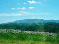 Black Mountain runs along the Kentucky-Virginia
border through Harlan and Bell counties. The highest point in Kentucky, 4,145 feet above sea level, is on Black Mountain near Lynch in Harlan county
Black Mountain runs along the Kentucky-Virginia
border through Harlan and Bell counties. The highest point in Kentucky, 4,145 feet above sea level, is on Black Mountain near Lynch in Harlan countyAdair, Allen, Anderson, Ballard, Barren, Bath, Bell, Boone, Bourbon, Boyd, Boyle, Bracken, Breathitt, Breckinridge, Bullitt, Butler, Caldwell, Calloway, Campbell, Carlisle, Carroll, Carter, Casey, Christian, Clark, Clay, Clinton, Crittenden, Cumberland, Daviess, Edmonson, Elliott, Estill, Fayette, Fleming, Floyd, Franklin, Fulton, Gallatin, Garrard, Grant, Graves, Grayson, Green, Greenup, Hancock, Hardin, Harlan, Harrison, Hart, Henderson, Henry, Hickman, Hopkins, Jackson, Jessamine, Johnson, Kenton, Knott, Knox, LaRue, Laurel, Lawrence, Lee, Leslie, Letcher, Lewis, Lincoln, Livingston, Logan, Lyon, Madison, Magoffin, Marion, Marshall, Martin, Mason, McCracken, McCreary, McLean, Meade, Menifee, Mercer, Metcalfe, Monroe, Montgomery, Morgan, Muhlenberg, Nelson, Nicholas, Ohio, Oldham, Owen, Owsley, Pendleton, Perry, Pike, Powell, Pulaski, Robertson, Rockcastle, Rowan, Russell, Scott, Shelby, Simpson, Spencer, Taylor, Todd, Trigg, Trimble, Union, Warren, Washington, Wayne, Webster, Whitley, Wolfe, Woodford

