

Click Image to Enlarge
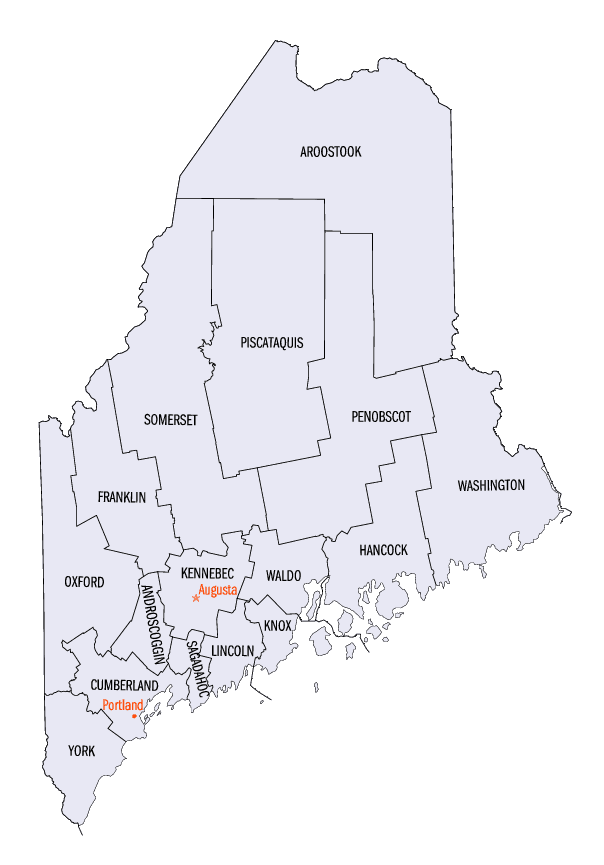
Maine Counties
There are sixteen Counties in Maine. Prior to statehood. The first county to be created was York County, created as York County, Massachusetts by the government of the Massachusetts Bay Colony in 1652. Maine was granted statehood on March 15, 1820 as part of the Missouri Compromise. Nine of the sixteen Counties had their borders defined while Maine was still part of Massachusetts, and hence are older than the state itself. Even after 1820, the exact location of the northern border of Maine was disputed with Britain, until the question was settled and the northern counties took their final, official form by treaty in 1845.Cumberland County, Maine
Cumberland County Education, Geography, and History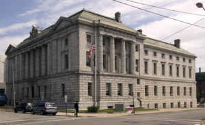
Cumberland County is a county located in the state of Maine. Based on the 2010 census, the population was 281,674, making it the most
populous county in Maine. Its county seat is Portland. Cumberland County was founded in 1760 from a portion of York County, Massachusetts and
named for William, Duke of Cumberland, a son of King George II.
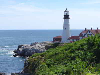
Cumberland County has the deepest and second largest body of water in the state, Sebago Lake, which supplies tap water to most of the county.
The county is the economic and industrial center of the state, having the resources of the Port of Portland, the Maine Mall, and having
corporate headquarters of major companies such as Fairchild Semiconductor, IDEXX Laboratories, Unum, and TD Bank.
Cumberland County is part of the Portland - South Portland, ME Metropolitan Statistical Area.
Etymology - Origin of Cumberland County Name
Cumberland is named for Prince William Augustus, Duke of Cumberland, son of George II of Great Britain.
Demographics:
County QuickFacts: CensusBureau Quick Facts
Cumberland County History
History of Cumberland County, Maine
From: A Gazetteer of the State of Maine
By Geo. J. Varney
Published by B. B. Russell, 57 Cornhill,
Boston 1886
Cuniberland County is situated in the south-western part of the State, and on the north-east of York County.
Oxford County bounds it on the west; Oxford, Androscoggin, Sagadahoc, on the north; and on the east lies the sea.
Enclosed between the promontory of Cape Elizabeth and Cape Small Point, just west of the mouth of the Kennebec, is
Casco Bay, "the fairest dimple on Ocean's cheek." It is one of the finest bays in the world, for its size, the
number of its havens, and the unchangeable nature of its shores, islands and bottom. The line between the two points
mentioned, which mark its outer ]imit, is about 25 miles; while the distance from this line to the inner shore of
the bay is about 15 miles. The name "Casco," is derived from the Indian word, Aucocisco; which, according to some
authorities signifies a resting-place, while others give it the interpretation of crane or heron. This bay is more
thickly studded with islands than any other body of water in the United States. They are of the most picturesque
forms; and about them bold headlands and, peninsulas jut far out into the quiet waters of the bay.
It is a popular compliment to the days of the year to say that Casco Bay has 365 islands. There are really 122
islands and islets,-not counting the rocks and reefs which might be made to swell the number possibly to 150. A few
of these still bear their aboriginal names, as Chebeague and Jebaskadiggin. The most beautiful island in the bay has
long borne the name of Hog Island; but Diamond Cove-" a jewel in a swine's snout "-is beginning to give its name to
the island in which it is contained. These islands naturally fall into three ranges, having the same general
direction as the long peninsulas on the northeastern side,-the enumeration of each range beginning next to Portland.
INNER RANGE.-Mackay's, The Brothers (2), Ten Pond, Clapboard, Sturdevant, Basket, Cousin's, Little John's, Lane's,
Moges, (2), Crab, Bibber's, Silver (4), two unnamed. MIDDLE RANGE.-Hog or Diamond (2), Cow, Crow Knob, Chebeague
(2), Crow, Irony, Goose Nest, Little Green, French, Whaleboat (2), Goose (2), Goslin (2), Shelter, Birch, White's,
four unnamed. OUTER RANGE.-House, Cashing's, Ram, Peaks, Pumpkin Knob, Overset, Marsh, Long, Stepping Stones (3),
Hope, Crotch, Jewell's, Sand, Outer Green (2), Broken Cave (3), Bates, Ministerial, Stave, Little Bangs, Stockman's,
Whale Rock, Haddock Ledge, Mark, Eagle, Upper Flag, Horse, Birch, Haskell's, Turnip, Jaquish, Bailey's, Orr's,
Jebaskadiggin, Pond, Ram No. 2, Cedar (6), Elm (2), Ragged, Bold Dick, White Bull, Little Bull, Sisters (2), Mark
No. 2, Brown Cow, Gooseberry, Wood (2), Burnt Coat, Jameson's Ledge, Lower Flag, Horse No. 2, Malaga, Bear, Rogue,
one unnamed, Jenny's, Yarmouth, two unnamed, Pote, Hopkin's, Bateman's, Long No. 2, three unnamed.
The bay is also as remarkable for its peninsulas as for its many islands. Between the sheltered waters of Fore River
and Back Cove, at its western extremity, extends Casco Neck, covered by the city of Portland. At the eastern end,
the long, narrow peninsula of Harpswell stretches out some eight miles into the quiet waters, flanked by many
islands. At this end the islands cluster thickest, and the mainland reaches out many fingers, between which creeks
and inlets and tidal rivers extend far inland; and the shore is fringed with picturesque "Points."
The principal river is the Presumpscot, which, in the 22 miles of its length, furnishes water-power to the amount of
20,846 horse-power, with a flow of unusual uniformity. Connected with this river are twenty-three distinct lakes,
with an agregate area of more than 90 square miles. Several of these, of which the chief are Lake Sebago and Long
Pond, are valuable for commercial navigation. This lake and pond are connected by a canal with Portland Harbor at
Fore River. Sebago Lake is a noble reservoir of the purest water in New England. The name is said to signify "a
stretch of water." It is distant from Portland 17 miles by the Portland and Ogdensburg Railroad. The lake is 14
miles long by 11 miles wide, and contains an area of 50 square miles. Its depth in some parts is 400 feet. Six towns
form its shores, and others are located on the connected lakes at the north. During the summer fine steamers daily
leave PavilIon Bay, near Lake Sebago Station, for Harrison Village, at the north-eastern extrniity of Long Pond.
Reaching the broader part of the lake, Rattlesneake Mountain, in Raymond, comes into 'view; and in the same
direction, but near the lake, may be seen the boyhood home of Nathaniel Hawthorne.
On the route are the fourteen Dingley Islands. On the west, the scenery is more rugged. Saddleback Mountain, in
Baldwin, is plainly visible, from which the eye roams north-east beyond the Great Bay, over the hills, forests and
farms of the town of Sebago. Still farther north is Peaked Mountain, beyond which the view extends north to Mount
Kiarsiirge (or Pequaket), standing blue and cold in the hazy distance; while, if the day is tolerably clear, the
White Mountains may be distinctly seen. The direct passage of the lake by steamer requires one hour, when the rapid
and devious Songo River is reached. It is but two and a half miles direct to the head of the river; but following
its course the boat must sail six miles and make twenty-seven turns, and pass a lock at the junction of Crooked, or
Pequaket River From the river, the boat enters the Bay of Naples, with Naples Village at its head; thence passes out
upon Long Pond, on the western side of which lies Bridgton, while Harrison forms the eastern shore.
Cumberland County has no high mountains. Its rocks, from Cumberland to Saco, are varieties of argillaceous slate,
with or without cleavage, and mica schist and talcose slate with magnesia. Eastward and northward of this, the two
last, with granite and trap, are the prevailing rocks.
The first settlement in the county was at Brunswick, in 1628, or earlier, by Thomas Purchas. The next was at
Richmond Island, by Walter Bagnall; then Cape Elizabeth and Portland, each a part of Falmouth at its incoporation.
The county was included in Gorges province of "Laconia," granted in 1622; in the "Plough Patent" (Lygonia), granted
to Dye and others, of London, in 1630, and sold by them to Sir Alexander Rigby; it was included also in the part
assigned to Gorges in the division of New England among the members of the New England or Plymouth Company, in
England, and named by him "New Somersetshire;" and, finally, in 1639, it was included in the charter from the king
to Gorges of the "Province of Mayne." After the purchase of the province by Massachusetts in 1677, it came under the
jurisdiction of that commonwealth, and was represented in its government; being included in the county of Yorkshire
until its organization under its present name in 1760. At first it embraced in addition to its present territory,
the counties of Androscoggin and Franklin, and parts of the present counties of Oxford, Kennebec and Somerset.
Cumberland contains twenty-five towns and one city. The Portland and Ogdensburgh Railroad passes westward through
the southern part; the north-eastern part is traversed by the Maine Central Railroad and its branches to Augusta and
Bath; and the Grand Trunk Railway from Lewiston and Canada to Portland.
The valuation of the county in 1870 was $48,942,323. In 1880 it was $556,460. The population in 1870 was 82,021. In
the census of 1880 it was 86,402....Cumberland
County
Geography: Land and Water
As reported by the Census Bureau, the county has a total area of 1,217 square miles (3,150 km2), of which 835 square miles (2,160 km2)
is land and 382 square miles (990 km2) (31%) is water.
Neighboring Counties
Bordering counties are as follows:
- Androscoggin County, Maine - north
- Oxford County, Maine - northwest
- Sagadahoc County, Maine - northeast
- York County, Maine - southwest
Education


Click Image to Enlarge
