


Click Image to Enlarge
Minnesota Counties
There are eighty-seven Counties in Minnesota. On October 27, 1849 nine large Minnesota Counties were created. Among them were Benton, Dahkotah, Itasca, Ramsey, Mahkahta, Pembina, Wabashaw, Washington, and Wahnata. Of those Benton, Dakota, Itasca, Ramsey, Wabasha, and Washington still exist as their original name. With the creation of Kittson County on March 9, 1878, Pembina County no longer existed. When Minnesota was organized as a state, 57 of the present 87 Counties were established. The last county to be created was Lake of the Woods County in 1923Lake Of The Woods County, Minnesota
Lake Of The Woods County Education, Geography, and History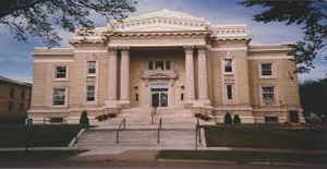
Lake of the Woods County is a county located in the state of Minnesota. Based on the 2010 census, the population was 4,045, making it the
second-least populous county in Minnesota. Its county seat is Baudette. The county was organized on November 28, 1922, though county functions
did not begin until 1923.
The county contains the Northwest Angle, the northernmost point of the Lower 48 States, and includes the US portion of Lake of the Woods,
shared with Canada. The county also includes the exclave of Elm Point. Since Alaska has no counties, Lake of the Woods is the northernmost
county in the United States. It is also the only county in the United States with four words in its name, although there is a parish in
Louisiana called St. John the Baptist Parish, and the US Census Bureau treats parishes as county equivalents for census purposes.
Etymology - Origin of Lake Of The Woods County Name
Named for Lake of the Woods. Translation of the Cree name for the lake. The lake was first mapped and named Lac des Bois in 1737
Demographics:
County QuickFacts: CensusBureau Quick Facts
Lake Of The Woods County History
Lake of the Woods County was named because the lake covers a large portion of the county. Jacques de Noyon, a Frenchman who came from Trois
Rivières, (Quebec), explored this area in 1688 and became the first white man to view the lake. He named the lake Lac aux Îles which means
"Lake of the Islands" in English.
In 1885 the region of Lake of the Woods got its first settler, Wilhem Zippel, who was a German immigrant and a fisherman. He settled on the
south shore of the lake in a place now called Zippel Bay. Shortly after, Alonzo Wheeler settled on a point on the southwest side of the lake
which is now called Wheeler's Point.
A terrible wildfire, which has come to be known as the Baudette Fire of 1910, broke out in October of that year, burning 300,000 acres (1,200
km2) and destroying the towns of Spooner, Baudette, Graceton, Pitt, Williams, and Cedar Spur. Lake of the Woods County was founded January 1,
1923, with Baudette as the original county seat. Lake of the Woods County is also known as Minnesota's youngest county. This county was
organized on November 28, 1922, when residents voted to separate the northern Townships.
Geography: Land and Water
As reported by the Census Bureau, the county has a total area of 1,775 square miles (4,600 km2), of which 1,298 square miles (3,360 km2) is land and 477 square miles (1,240 km2) (27%) is water.
Neighboring Counties
Bordering counties are as follows:
- Kenora District, Ontario (northeast)
- Rainy River District, Ontario (northeast)
- Koochiching County (southeast)
- Beltrami County (south)
- Roseau County (west)
- Rural Municipality of Piney, Manitoba (west)
- Buffalo Point, Manitoba (west)
- Division No. 1, Unorganized, Manitoba (northwest)
Education


Click Image to Enlarge
