


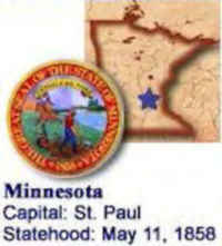
Minnesota State Almanac: Facts and Figures
Quick Facts, Figures, and Overview of the State of Minnesota
Minnesota is one of the West North Central states of the US.It shares a Lake Superior water border with Michigan and a land and water border with Wisconsin to the east. Iowa is to the south, North Dakota and South Dakota are to the west, and the Canadian provinces of Ontario and Manitoba are to the north. Minnesota is famously nicknamed as the "Land of 10,000 lakes", since there are about 11,842 lakes in the state. Minnesota is the 21st most populous state of United States. Minnesota's name come from the named the Dakota Sioux used for the river's "cloudy" or "milky water." The Dakota word "mnishota" means "cloudy" or "milky water."
Minnesota's economy has long been dominated by the development of its varied natural resources. By the 1990s, although it remained a leading agricultural
state, Minnesota had developed a diversified economy, dominated by services and manufacturing. Minnesota's factories produce nonelectrical machinery,
fabricated metals, flour-mill products, plastics, electronic computers, scientific instruments, and processed foods. The state is also a leader in
the printing and paper-products industries.
Minneapolis is the trade center of the Midwest, and the headquarters of the world's largest super-computer and grain distributor. St. Paul is the nation's
biggest publisher of calendars and law books. These "twin cities"are the nation's third-largest trucking center. Duluth has the nation's
largest inland harbor and now handles a significant amount of foreign trade. Rochester is home to the Mayo Clinic, a world-famous medical center.
Tourism is a major revenue producer in Minnesota, with arts, fishing, hunting, water sports, and winter sports bringing in millions of visitors
each year.
Minnesota Almanac: Facts on the State of Minnesota |
|||
|---|---|---|---|
| Official Name | Minnesota | ||
| Capital | St. Paul | ||
| Nicknames | North Star State; Gopher State; Land of 10,000 Lakes ...and more | ||
| Motto | L'Etoile du Nord (The star of the north) | ||
| Location Region |
44.83945 N, 092.99496 W Midwest Northwestern |
||
| Constitution Ratified | 1858 | ||
| Statehood | May 11, 1858 32nd state |
||
| Population | 5,303,925 (2010) 61.79 sq. mi. 21st |
||
| Largest City (by population) |
10 largest cities (2010): Minneapolis, 382,578; St. Paul, 285,068; Rochester, 106,769; Duluth, 86,265; Bloomington, 82,893 Brooklyn Park, 75,781; Plymouth, 70,576; St. Cloud, 65,842; Eagan, 64,206; Woodbury, 61,961 | ||
| Bordering States | North: Canadian provinces of Manitoba and Ontario East: Lake Superior and Wisconsin South: Iowa (Mississippi River forms part of the Southeastern border) West: South Dakota and North Dakota (Red River of the North forms much of the Western border) |
||
| Major Industry | farming (corn, soybeans, sugar beets, wheat, dairy products), paper pulp, mining (iron ore) | ||
| Major Rivers | Minnesota River, Mississippi River, Rainy River, Red River of the North, St. Croix River | ||
| Major Lakes | Upper Red Lake, Lower Red Lake, Mille Lacs Lake, Vermillion Lake, Rainy Lake, Lake of the Woods, Lake Superior, Leech Lake, Winnibigoshish Lake, Lake Pepin | ||
| Minnesota Counties | 87 Counties in Minnesota | ||
| Largest County (by population) |
Hennepin County 1,152,425 (2010) 557 sq. mi. |
||
| Largest County (by area) |
St. Louis County 6,226 sq mi. |
||
| State forests | 58 (nearly 4 million ac.) | ||
| State parks | 72 | ||
| Electoral Votes | 10 | ||
| US Congress | 2 Senators; 8 Representatives | ||
| Time Zone | Central Standard Time | ||
| Zip Codes | NANPA | ||
| State Quick Facts | Census Bureau Quick Facts | ||
Minnesota Climate and Weather |
||
|---|---|---|
| Minnesota's winter climate is a bit extreme for those who aren't fans of wind chill, but summer and fall are very pleasant. In winter, the temperature ranges from -9 to 24 F/-22 to -4 C, though it can be even colder. Statewide snowfall averages 30-40 in/76-102 cm. April can be an unattractive time to visit: late snowfalls, melting snow and chilly temperatures are common. Summer is by far the most appealing season, with July having the most sun (average temperatures: 53-84 F/11-27 C). June-August sees warm days (highs in the 90s F/32+ C are quite likely) and cool nights (50s-65 F/10-18 C). | ||
| Highest Temperature | 114 degrees July 6, 1936 - Moorhead |
|
| Lowest Temperature | -60 degrees February 2, 1996 - Tower. |
|
| Avg. Temp: High - Low |
83.4 degrees -2.9 degrees |
|
Minnesota Points of Interest |
||
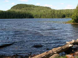
| The Boundary Waters Region, Itasca State Park and the Mississippi River headwaters, Red River Valley, North Shore, sparklingly Minneapolis and historic Saint Paul, Glacial Ridge Trail and the Saint Croix River to name but a few. | ||
Minnesota Highest, Lowest, and Mean Elevations (Feet) |
||
| Mean Elevation: 1,200 feet | ||
| Highest Point: Eagle Mountain: 2,301 feet
|
||
| Lowest Point: | Lake Superior 600 feet |
|
Minnesota Land Area (Square Miles) |
||
| Geographic Center | In Crow Wing County, 10 mi. SW of Brainerd Longitude: 95°19.6'W Latitude: 46°1.5'N |
|
| Total Area | 86,938.87 sq. mi 12th |
|
| Land Area | 79,610.08 sq. mi | |
| Water Area | 7,328.79 sq. mi 8.42% |
|
| Forested Land Area | 33% | |
| Dimensions (Length - Width) |
400 miles - 250 miles | |
 Eagle Mountain is the tallest point
in the state of Minnesota. It rises over 300 feet above Brule Lake in the BWCA. The US Geological Survey has installed a metal plaque marking Minnesota's
official highest point. At 2,301 feet above sea level, the peak is lofty for a Midwestern summit, but small by mountaineering standards.
Eagle Mountain is the tallest point
in the state of Minnesota. It rises over 300 feet above Brule Lake in the BWCA. The US Geological Survey has installed a metal plaque marking Minnesota's
official highest point. At 2,301 feet above sea level, the peak is lofty for a Midwestern summit, but small by mountaineering standards.Aitkin, Anoka, Becker, Beltrami, Benton, Big Stone, Blue Earth, Brown, Carlton, Carver, Cass, Chippewa, Chisago, Clay, Clearwater, Cook, Cottonwood, Crow Wing, Dakota, Dodge, Douglas, Faribault, Fillmore, Freeborn, Goodhue, Grant, Hennepin, Houston, Hubbard, Isanti, Itasca, Jackson, Kanabec, Kandiyohi, Kittson, Koochiching, Lac Qui Parle, Lake, Lake Of The Woods, Le Sueur, Lincoln, Lyon, Mahnomen, Marshall, Martin, McLeod, Meeker, Mille Lacs, Morrison, Mower, Murray, Nicollet, Nobles, Norman, Olmsted, Otter Tail, Pennington, Pine, Pipestone, Polk, Pope, Ramsey, Red Lake, Redwood, Renville, Rice, Rock, Roseau, Scott, Sherburne, Sibley, St. Louis, Stearns, Steele, Stevens, Swift, Todd, Traverse, Wabasha, Wadena, Waseca, Washington, Watonwan, Wilkin, Winona, Wright, Yellow Medicine

