


Minnesota Geography: The Land
Geography and Landforms of Minnesota
 Find an overview of Minnesota geography,
topography, geographic land regions, land areas, and major rivers.
Find an overview of Minnesota geography,
topography, geographic land regions, land areas, and major rivers.
Access Minnesota almanac, furnishing more details on the state geography, geographical and land regions, climate and weather, elevation, land areas, bordering states, and other statistical data.
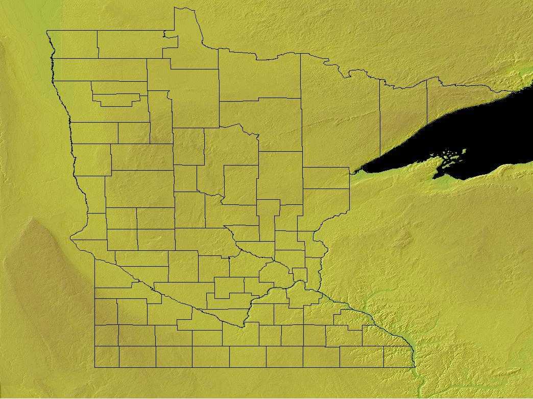
Minnesota is bordered by Canada on the north and by Iowa on the south. On the east, Minnesota is bordered by Lake Superior and by Wisconsin. On the west are North and South Dakota.
Most of Minnesota is made of rolling plains that were created by retreating glaciers. These areas are covered by fertile topsoil. Though some sections are sandy and stony, this area has some of the richest farmland in the United States. The northern part of Minnesota is the most rugged. The northeast section of the state has many rocky ridges and deep lakes, with the areas north of Lake Superior the roughest, including Eagle Mountain, the highest point in Minnesota. Along the Mississippi River, in the southeastern section of the state, the land is fairly flat, but cut by deep valleys created by fast flowing rivers and streams.
Minnesota Highest, Lowest, & Mean Elevations |
|
|---|---|
| Mean Elevation | 1,200 ft. |
| Highest Point | Eagle Mountain 2,301 ft. |
| Lowest Point | Lake Superior 600 ft. |
Minnesota Land Area (Square Miles) |
|
| Geographic Center | In Crow Wing County, 10 mi. SW of Brainerd Longitude: 95° 19.6'W Latitude: 46° 1.5'N |
| Total Area | 86,938.87 sq. mi. 12th |
| Land Area | 79,610.08 sq. mi. |
| Water Area | 7,328.79 sq. mi. 8.42% |
| Forested Land Area | 33% |
| Dimensions (Length - Width) |
400 miles - 250 miles |
Minnesota: Physiographic Regions
Two major physiographic regions comprise Minnesota.
- Superior Upland province
- Central Lowlands
Its northeastern portion falls within the Superior Upland province, part of the huge territory of ancient, long-stable continental bedrock called the Canadian Shield. The Precambrian rock of this province is among the oldest exposed on the continent. The Central Lowlands occupy the rest of Minnesota.
Superior Upland Province
Superior Upland, geographic region in northern Wisconsin, Minnesota, and Michigan, U.S., lying south and west of Lake Superior. A southern extension of the Canadian Shield of ancient mountain ranges, it is composed of crystalline rock with little overlying soil. Pleistocene glaciation (the southward movement of ice that began approximately 2.6 million years ago) scraped most of the land bare. Agriculture is thus limited, but the region has yielded much iron ore and is ruggedly scenic.
Central Lowlands Province
The Central Lowland province, the largest physiographic province, cover an area about 585,000 miles which extends from western New York to North Dakota and south to Texas. The majority of the province is bounded by higher relief and elevations in the region are 2,000 feet or less. The province is part of the Interior Plains division of the United States and characteristic features of the Central Lowland province are flat lands with geomorphic remnants of glaciation.
Minnesota Landscape and Landforms:
Aspen Parklands
Most of the Aspen Parklands is in Manitoba, Saskatchewan, and Alberta, with only a small portion entering the United States in northern Minnesota.
Boreal Hardwood Transition
As the name implies, this area is a transition zone between the mixed hardwood forest to the south and the boreal forest to the north. Northern Minnesota, Wisconsin, and Michigan are in this physiographic area, as is much of southern Ontario and a small area of southeast Manitoba. The Great Lakes are a prominent ecological force in this area, affecting microclimates and forest community composition. These forest communities are a heterogeneous matrix with various oaks, maples, birch, and pines representing the southern element and spruces, tamarack, and balsam fir of boreal origin. Aspen is a common early successional species
Dissected Till Plains
The Dissected Till Plains occupy much of Iowa, eastern Nebraska, northwest Missouri, and small parts of northwest Illinois, southern Minnesota, and northeast Kansas. This area was glaciated, uplifted, and subsequently eroded into a flat-to-rolling terrain that slopes gently toward the Missouri and Mississippi River Valleys. Natural vegetation is a mosaic of tallgrass bluestem prairie and oak-hickory forest with oak savannahs characteristic of transition zones. Bottomland hardwoods grow in river valleys.
Northern Tallgrass Prairie
This is the easternmost and lushest region of the Great Plains at this latitude. It includes north-central Iowa, south- central and western Minnesota, the Red River Valley of North Dakota, and extends into south- central Manitoba. Tallgrass prairie grades into savannah on its eastern boundary. The transition zone has doubtlessly shifted over time with changes in the patterns of fire, drought, and herbivory that maintain the prairie. Similar forces affect the boundary with Aspen Parkland to the northeast and north. Drier conditions result in shorter grasses as the tallgrass gives way to the Mixed Grass Prairie at the western edge of the Red River Valley. The entire Northern Tallgrass was subjected to recent glaciation, resulting in a dense distribution of wetland depressions away from the geologically younger river valleys. The southernmost border of this glaciation created the boundary between this physiographic area and the Dissected Till Plains.
Upper Great Lakes Plain
The Upper Great Lakes Plain covers the southern half of Michigan, northwest Ohio, northern Indiana, northern Illinois, southern Wisconsin, and small portions of southwest Minnesota and northwest Iowa. Glacial moraines and dissected plateaus are characteristic of the topography. Broadleaf forests, oak savannahs, and a variety of prairie communities are the natural vegetation types. A "Driftless Area" was not glaciated during the late Pleistocene and emerged as a unique area of great biological diversity.
The Lower Peninsula is fairly level but some low rolling hills can be found in the south. To the north this changes to a northern tableland of hilly belts. The lowest point in Michigan, along the shore of Lake Erie is found in the Lower Peninsula.
Arrowhead Country
The northern part of Minnesota is the most rugged. The northeast section of the state has many rocky ridges and deep lakes and the area north of Lake Superior is the roughest and most isolated. Eagle Mountain, the highest point in Minnesota, is located north of Lake Superior. In the far northeast, the Minnesota border resembles an arrowhead. This area is called the Arrowhead Country.
Rolling Plains
Most of Minnesota is comprised of gently rolling plains formed when glaciers moved over the area. About half of Minnesota is covered by the rolling plains left by the ice age. These areas are covered by fertile topsoil. Though some sections are sandy and stony, this area has some of the richest farmland in the United States.
Southern Section
Along the Mississippi River, in the southeastern section of the state, the land is relatively flat, cut by deep valleys created by fast flowing rivers and streams.
In southwestern Minnesota, glaciers left thick deposits of sand, gravel, and clay. This area is criss-crossed by many streams. The few flat areas make good farmland.

