


Click Image to Enlarge
Mississippi Counties
There are eighty counties in Mississippi. Two original counties were Adams County and Jefferson County (formerly Pickering) established in 1799Tippah County, Mississippi
Tippah County Education, Geography, and History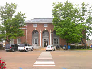
Tippah County is a county located on the northern border of the state of Mississippi. Based on the 2010 census, the population was 22,232. Its county seat is Ripley. The name "Tippah" is derived from a Chickasaw language word meaning "cut off." It was taken from the creek of the same name that flows across much of the original county from northeast to southwest before emptying into the Tallahatchie River. The creek probably was so named because it, and the ridges on either side, "cut off" the western part of the region from the eastern portion.
Etymology - Origin of Tippah County Name
Tippah is named for Tippah, wife of Pontotoc, an important Chickasaw leader.
Demographics:
County QuickFacts: CensusBureau Quick Facts
Tippah County History
Tippah County was established February 9, 1836, and was named for the wife of Pontotoc, a Chickasaw Indian chief, the name signifying "cut off."It was one of the twelve counties created out of the Chickasaw cession of 1882. It was originally a very large county of about 27 townships and embraced within its area a large part of the present county of Benton, as well as the northern portion of Union and the western portions of Alcorn and Prentiss counties. The county seat of Tippah is Ripley. Its original limits were defined as follows:
"Beginning at the point where the line between townships 6 and 7 intersects the basis meridian, to the northern boundary line of the State; thence east with the said boundary line, to the line between ranges 5 and 6 east; thence south with the said range line, to the line between townships 6 and 7; and thence west with the said township line to the beginning."
In 1873, parts of the original county were detached to form parts of
Alcorn, Benton and Union counties.
Many wealthy and substantial planters, merchants and professional men came
to the region in the early '30s, and settled along the banks of its streams.
Among the early settlements of those years, which flourished for a time, but
are now moribund, may be mentioned Salem, Orizaba and Ruckersville. Salem
was first settled in 1836, incorporated 1837. It was two or three miles west
of Ashland in what was then Tippah County, and was absorbed by the latter
place.
Geography: Land and Water
As reported by the Census Bureau, the county has a total area of 460
square miles (1,191 km2), of which, 458 square miles (1,186 km2) of it is
land and 2 square miles (5 km2) of it (0.45%) is water.
Neighboring Counties
Bordering counties are as follows:
- Hardeman County, Tennessee (north)
- Alcorn County (northeast)
- Prentiss County (southeast)
- Union County (south)
- Benton County (west)
Education


Click Image to Enlarge
