


Mississippi State Almanac: Facts and Figures
Quick Facts, Figures, and Overview of the State of Mississippi
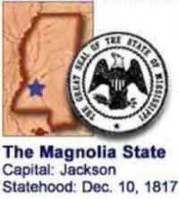
Mississippi is one of the East South Central states of the US. The capital and largest city of the state is Jackson. Mississippi is bordered on the north by Tennessee, on the east by Alabama, on the south by Louisiana and a narrow coast on the Gulf of Mexico and on the west, across the Mississippi River, by Louisiana and Arkansas. Mississippi's name was derived from the Chippewa; mici zibi, "great river" or "gathering-in of all the waters." Also: Algonquin word, "Messipi."
Mississippi economy was mainly agricultural until the middle third of the 20th century, from shortly after the state's founding through the Great Depression, cotton was the undisputed king of Mississippi's largely agrarian economy. Over the last half-century, however, Mississippi has diversified its economy by balancing agricultural output with increased industrial activity.
Today, agriculture continues as a major segment of the state's economy. For almost four decades soybeans occupied the most acreage, while cotton remained the largest cash crop. In 2001, however, more acres of cotton were planted than soybeans, and Mississippi jumped to second in the nation in cotton production (exceeded only by Texas). The state's farmlands also yield important harvests of corn, peanuts, pecans, rice, sugar cane, and sweet potatoes as well as poultry, eggs, meat animals, dairy products, feed crops, and horticultural crops. Mississippi remains the world's leading producer of pond-raised catfish.
Mississippi Almanac: Facts about Mississippi |
|
|---|---|
| Official Name | Mississippi |
| Capital | Jackson |
| Nicknames | Magnolia State ... and more |
| Motto | Virtute et Armis (By valor and arms) |
| Location Region |
32.32050 N, 090.20759 W Southern Appalachia |
| Constitution Ratified | 1890 |
| Statehood | December 10, 1817 20th state |
| Population | 2,967,297 (2010) 60.64 sq. mi. 31st |
| Largest City (by population) |
10 largest cities (2010): Jackson, 173,514; Gulfport, 67,793; Hattiesburg, 51,993; Southhaven, 48,982; Biloxi, 44,054; Meridian, 41,198; Tupelo, 34,546; Greenville, 34,400; Olive Branch, 33,484; Horn Lake 26,066 |
| Bordering States | North: Tennessee East: Alabama South: Gulf of Mexico and Louisiana (Pearl River forms part of the Southern boundary) West: Louisiana and Arkansas (Mississippi River forms almost all of the Western boundary) |
| Major Industry | farming (cotton, corn, soybeans, rice), oil, textiles, electronic equipment, transportation equipment, fishing |
| Major Rivers | Mississippi River, Big Black River, Pearl River, Yazoo River |
| Major Lakes | Ross Barnett Reservoir, Arkabutla Lake, Sardis Lake, Grenada Lake |
| Mississippi Counties | 82 Counties in Mississippi |
| Largest County (by population) |
Hinds County 245,285 (2010) 569 sq. mi. |
| Largest County (by area) |
Yazoo County 920 sq. mi. |
| State parks | 24 |
| Electoral Votes | 6 (as of the 2004 Presidential Election) |
| US Congress | 2 Senators; 5 Representatives (4 Representatives as of the 2002 election) |
| Time Zone | Central Standard Time |
| Zip Codes | NANPA |
| State Quick Facts | Census Bureau Quick Facts |
Mississippi Climate and Weather |
|
|---|---|
| Mississippi has hot, humid summers and relatively mild winters. Winter temperatures run 31 to 60 F/-1 to 15 C, though they can drop to 32 F/0 C or lower on occasion, even as far south as the Gulf. Though mild, winter has the most rainfall. High humidity and temperatures of 90 F/32 C and higher are common in summer. Biloxi, though farthest south, is cooled by breezes from the Mississippi Sound and has fewer days of high heat. Spring and fall the temperatures and humidities are most comfortable then. Expect March-May to provide temperatures from 43 to 85 F/6 to 29 C, with humidity running in the 54% to 85% range (humidity levels tend to decrease in the midday and afternoon hours in the South). Fall is drier, with clear, sunny days and temperatures similar to those in spring. Lows may be a bit lower, but not substantially so. The weather is normally more stable in the fall; spring can have some severe thunderstorms and occasional tornadoes. | |
| Highest Temperature | 115 degrees July 29, 1930 - Holly Springs |
| Lowest Temperature | -19 degrees January 30, 1966 - Corinth |
| Avg. Temp: High - Low |
92.5 degrees 34.9 degrees |
Mississippi Points of Interest |
|
|
All visitors
to Mississippi, the "Magnolia State", get a taste of the Deep South, and its welcoming hospitality and rich history.
Significant battles of America's Civil War occurred in Mississippi, and one of the most important of all was fought at Vicksburg, which today is a national park. Other National Park Service areas are Brices Cross Roads National Battlefield Site, Tupelo National Battlefield, and part of Natchez Trace National Parkway. Pre-Civil War mansions are the special pride of Natchez, Oxford, Columbus, Vicksburg, and Jackson. In addition to the hundreds of historic sites spread across the state, additional attractions include sandy beaches along the Gulf Coast, thousands of acres of state parks, beautiful antebellum homes and plantation mansions, and casinos and riverboat gambling venues. |
|
Mississippi Highest, Lowest, and Mean Elevations (Feet) |
|
| Mean Elevation: 300 feet | |
|
Highest Point: Woodall Mountain: 806 feet
|
|
| Lowest Point: | Gulf of Mexico Sea level |
Mississippi Land Area (Square Miles) |
|
| Geographic Center | In Leake County, 9 mi. WNW of Carthage Longitude: 89°43.0'W Latitude: 32°48.9'N |
| Total Area | 48,430.19 sq. mi 32nd |
| Land Area | 46,906.96 sq. mi 96.86% |
| Water Area | 1,523.24 sq. mi 3.14% |
| Forested Land Area | 61.9% |
| Dimensions (Length - Width) |
340 miles - 170 miles |
 Woodall Mountain, near Iuka,
is the state's highest point of elevation, and rests peacefully at the base of the Appalachian Mountains. Pickwick Lake, grand and glistening, and
Tishomingo State Park, in all its green glory, are popular stops.
Woodall Mountain, near Iuka,
is the state's highest point of elevation, and rests peacefully at the base of the Appalachian Mountains. Pickwick Lake, grand and glistening, and
Tishomingo State Park, in all its green glory, are popular stops.Adams, Alcorn, Amite, Attala, Benton, Bolivar, Calhoun, Carroll, Chickasaw, Choctaw, Claiborne, Clarke, Clay, Coahoma, Copiah, Covington, DeSoto, Forrest, Franklin, George, Greene, Grenada, Hancock, Harrison, Hinds, Holmes, Humphreys, Issaquena, Itawamba, Jackson, Jasper, Jefferson, Jefferson Davis, Jones, Kemper, Lafayette, Lamar, Lauderdale, Lawrence, Leake, Lee, Leflore, Lincoln, Lowndes, Madison, Marion, Marshall, Monroe, Montgomery, Neshoba, Newton, Noxubee, Oktibbeha, Panola, Pearl River, Perry, Pike, Pontotoc, Prentiss, Quitman, Rankin, Scott, Sharkey, Simpson, Smith, Stone, Sunflower, Tallahatchie, Tate, Tippah, Tishomingo, Tunica, Union, Walthall, Warren, Washington, Wayne, Webster, Wilkinson, Winston, Yalobusha, Yazoo

