


Click Image to Enlarge
Ohio Counties
There is eighty-eight counties in the state of Ohio. Washington County the oldest in the state established on July 27, 1788. Noble County was formed on March 11, 1851 from portions of Guernsey, Morgan, Monroe and Washington counties. It was the last county to be formed in Ohio and, therefore, represents the youngest county in the state.Adams County, Ohio
Adams County Education, Geography, and History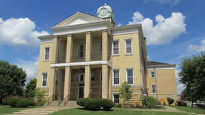
Adams County is a county located in the state of Ohio. Based on the 2010 census, the population was 28,550. Its county seat is West Union. The county is named after John Adams, the second President of the United States
Etymology - Origin of Adams County Name
The county was named after John Adams, the President of the United States in 1797
Demographics:
County QuickFacts: CensusBureau Quick Facts
Adams County History
Arthur St. Clair established Adams County on July 10, 1797. He named the county after John Adams, the President of the United States in 1797. It was one of the first four counties created in the Northwest Territory. In 1795, Nathaniel Massie founded Manchester, the first permanent white
settlement in Adams County.
Adams County is a rural area, located approximately fifty miles east of Cincinnati along the Ohio River. It consists of 625 square miles of land. West Union is the county seat and it is the largest town in the county. In 2000 the population of West Union was just over 2,900 people. The county
averages forty-seven people per square mile. Approximately eighty percent of the residents find employment in service industries. These industries include medical care, utilities, and communications. Just over seven percent of the population is engaged in agriculture, and especially in dairy
farming. The average income per person in 1999 was just over sixteen thousand dollars. Adams County is one of the poorest counties in Ohio. Approximately eighteen percent of all residents live in poverty. Many residents describe the county as the "Edge of Appalachia." Politically, the county's
residents are predominantly Republican.
Serpent Mound, an Indian earthwork and an Ohio Historical Society site, is located in Adams County.
Sources
Adams County Ohio History Central, July 23, 2008,
http://www.ohiohistorycentral.org/entry.php?rec=1888&nm=Adams-County
Geography: Land and Water
As reported by the Census Bureau, the county has a total area of 586 square miles (1,520 km2), of which 584 square miles (1,510 km2) is land and 2.4 square miles (6.2 km2) (0.4%) is water. It includes many parks and preserves including one of Ohio's greatest archeological wonders, the Serpent Mound at the Serpent Mound State Memorial in Locust Grove. Serpent Mound lends its name to the Serpent Mound crater, the eroded remnant of a huge ancient meteorite impact crater.
Neighboring Counties
Bordering counties are as follows:
- Highland County (north)
- Pike County (northeast)
- Scioto County (east)
- Lewis County, Kentucky (south)
- Mason County, Kentucky (southwest)
- Brown County (west)
Education


Click Image to Enlarge
